
IMAGES TAKEN NEAR TO
Whitman Way, WARWICK, CV34 6TX
Introduction
This page details the photographs taken nearby to Whitman Way, CV34 6TX by members of the Geograph project.
The Geograph project started in 2005 with the aim of publishing, organising and preserving representative images for every square kilometre of Great Britain, Ireland and the Isle of Man.

There are currently over 7.5m images from over14,400 individuals and you can help contribute to the project by visiting https://www.geograph.org.uk
Image Map
Images are licensed for reuse under creativecommons.org/licenses/by-sa/2.0
Notes
- Clicking on the map will re-center to the selected point.
- The higher the marker number, the further away the image location is from the centre of the postcode.
Image Listing (102 Images Found)
Images are licensed for reuse under creativecommons.org/licenses/by-sa/2.0
Image
Details
Distance
1
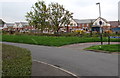
Recently-built houses viewed from Shelley Avenue, Warwick
View in early October 2015 across Gog Brook. The houses are not yet shown in the maps I use,
all of which show a green field here on the south bank of Gog Brook in the grounds of Aylesford School.
Image: © Jaggery
Taken: 3 Oct 2015
0.03 miles
2
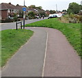
Path to Shelley Avenue, Warwick
The path from Mander Grove approaches Shelley Avenue.
Image: © Jaggery
Taken: 3 Oct 2015
0.03 miles
3
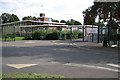
Newburgh Primary School, Kipling Avenue, Warwick
Image: © Robin Stott
Taken: 28 Aug 2009
0.06 miles
4
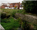
Gog Brook, Warwick
Viewed from this http://www.geograph.org.uk/photo/4689452 footbridge.
Image: © Jaggery
Taken: 3 Oct 2015
0.07 miles
5
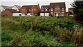
Shreres Dyche houses, Warwick
Viewed across Gog Brook. I don't know the origins of the street name Shreres Dyche.
Dyche could be an Old English form of ditch or dyke, but that's only a guess.
Image: © Jaggery
Taken: 3 Oct 2015
0.07 miles
6
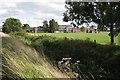
Aylesford School, Warwick
One of Warwick's two state secondary schools, seen across the channel of the Gog Brook from Shelley Avenue.
Image: © Robin Stott
Taken: 28 Aug 2009
0.07 miles
7
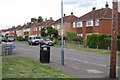
Masefield Avenue, Forbes Estate, Warwick
Why Forbes I have yet to find out, but all the roads are named after English poets.
Image: © Robin Stott
Taken: 28 Aug 2009
0.08 miles
8
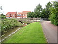
Bridge over Gog Brook
This is a view south-west along Gog Brook towards the bridge between Chase meadow and the adjacent residential estate. The brook often has ducks and finches along its banks.
Image: © Jeremy Worrell
Taken: 17 Jun 2007
0.09 miles
9
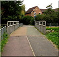
Gog Brook footbridge, Warwick
The bridge carries a footpath and cycleway over the brook. http://www.geograph.org.uk/photo/468954 to a side view.
Image: © Jaggery
Taken: 3 Oct 2015
0.09 miles
10
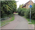
Cycle lane - look both ways, Warwick
The blue sign is at a path junction near Gog Brook. http://www.geograph.org.uk/photo/4689472
Image: © Jaggery
Taken: 3 Oct 2015
0.09 miles