
IMAGES TAKEN NEAR TO
Banbury Road, WARWICK, CV34 6SS
Introduction
This page details the photographs taken nearby to Banbury Road, CV34 6SS by members of the Geograph project.
The Geograph project started in 2005 with the aim of publishing, organising and preserving representative images for every square kilometre of Great Britain, Ireland and the Isle of Man.

There are currently over 7.5m images from over14,400 individuals and you can help contribute to the project by visiting https://www.geograph.org.uk
Image Map
Images are licensed for reuse under creativecommons.org/licenses/by-sa/2.0
Notes
- Clicking on the map will re-center to the selected point.
- The higher the marker number, the further away the image location is from the centre of the postcode.
Image Listing (22 Images Found)
Images are licensed for reuse under creativecommons.org/licenses/by-sa/2.0
Image
Details
Distance
1
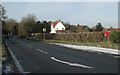
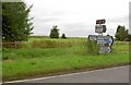
Asps Cottages and A425 lay-by
Postbox number CV34 96. On the left the A425 is nearing the junction with the Barford road, aka Flatrabbit Lane. Farm buildings at 'The Asps' show on the right.
Image: © Robin Stott
Taken: 17 Dec 2010
0.02 miles
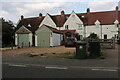
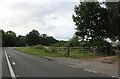
4
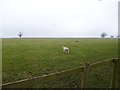
Bishop's Tachbrook, sheep grazing
Next to Asps Cottages.
Image: © Mike Faherty
Taken: 17 Feb 2013
0.04 miles
5
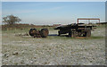
Farm trailer near 'The Asps'
The white object in the distance is the recently-completed Gurdwara or Sikh temple south of Leamington Image
Image: © Robin Stott
Taken: 17 Dec 2010
0.05 miles
7
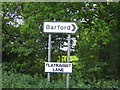
Flatrabbit Lane
The name for the road to Barford. There is a high population of rabbits in this area, however not all survive as the name indicates!
Image: © David Stowell
Taken: 28 May 2005
0.07 miles
8
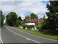
The Warwick Road at the Asps
Looking NNE along the A425 Warwick Road at the Barford Road junction with The Asps on the right straddling the northern boundary of the square.
Image: © David Stowell
Taken: 28 May 2005
0.07 miles
9
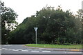
Banbury Road at the junction of The Belt
Image: © David Howard
Taken: 1 Aug 2021
0.07 miles
10
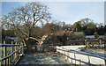
Footpath behind 'The Asps'
Nice walnut tree on the left with part of 'The Asps Cottage' beyond. 'The Asps' farmhouse and farm buildings extend to the right.
Image: © Robin Stott
Taken: 17 Dec 2010
0.08 miles