
IMAGES TAKEN NEAR TO
Jack Cade Way, WARWICK, CV34 6GH
Introduction
This page details the photographs taken nearby to Jack Cade Way, CV34 6GH by members of the Geograph project.
The Geograph project started in 2005 with the aim of publishing, organising and preserving representative images for every square kilometre of Great Britain, Ireland and the Isle of Man.

There are currently over 7.5m images from over14,400 individuals and you can help contribute to the project by visiting https://www.geograph.org.uk
Image Map
Images are licensed for reuse under creativecommons.org/licenses/by-sa/2.0
Notes
- Clicking on the map will re-center to the selected point.
- The higher the marker number, the further away the image location is from the centre of the postcode.
Image Listing (57 Images Found)
Images are licensed for reuse under creativecommons.org/licenses/by-sa/2.0
Image
Details
Distance
1
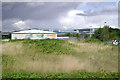
Vacant plot, Titan Business Centre, south Leamington
Looking across premises in Delphi Close (retailer/trade sales) to Spa Park and the Wolseley development (major distributor of the same products) Image All very quiet at the moment, as a thunderstorm gathers over Leamington. It's not just meteorological, it's economic!
Image: © Robin Stott
Taken: 30 Jul 2009
0.08 miles
2

Leamington Spa-Heathcote Lane
Industrial Unit in Spartan Close.
Image: © Ian Rob
Taken: 9 Jul 2012
0.09 miles
3
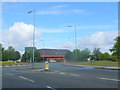
Heathcote Lane Roundabout
This roundabout is at the junction of Heathcote Lane and Tachbrook Park Drive. The buildings on the right are on the industrial estate and business park.
Image: © Nigel Mykura
Taken: 28 Aug 2011
0.09 miles
5
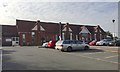
A lodge at the Royal Leamington Spa Rehabilitation Hospital, Heathcote Lane
The hospital has greatly increased in size over the years. It is part of the South Warwickshire NHS Foundation Trust (SWIFT). It is home to the Central England Rehabilitation Unit (CERU).
A map of 1905 is the first to show a hospital here: Heathcote Sanatorium (Warwick & Leamington Corporations). In 1925 the site was called Heathcote Hospital (Infectious Diseases). By 1939 it was called Isolation Hospital. Originally it consisted of a number of buildings (including a mortuary) on each side of a drive at right-angles to modern Heathcote Lane. David Stowell's Image from 2005 gives an impression. The building pictured is on the right. It appears now to house ancillary services for patients and staff.
Image: © Robin Stott
Taken: 18 Sep 2019
0.09 miles
6
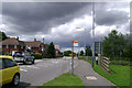
Heathcote Lane, south Leamington
Looking towards Heathcote Rehabilitation Hospital Image
Image: © Robin Stott
Taken: 30 Jul 2009
0.10 miles
7
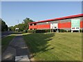
Units to let, Titan Business Park, Heathcote, Leamington
Seen from the south end of Tachbrook Park Drive.
Image: © Robin Stott
Taken: 20 Sep 2020
0.10 miles
8
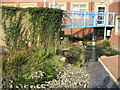
View of courtyard garden
This is a view of the courtyard garden at the hospital, designed for patient use. It includes a sensory area and fish pond.
Image: © Verity Stokes
Taken: 19 Oct 2007
0.12 miles
9
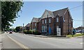
Whitnash Lodge and Heathcote Lane, Leamington
The extended Whitnash Lodge is believed to be the unit of the Rehabilitation Hospital that treats brain injuries. For a little history see https://www.geograph.org.uk/photo/6414082 A charity, the Central England Brain Injury Charity, raises funds to enhance the facilities at the Central England Rehabilitation Unit (CERU): http://www.ceru.co.uk/?fbclid=IwAR111-mmr13zPvnIB-EobP1Or5cAJ-UHjMqGAann2suHG6FAatv-Dj72CQQ
Image: © Robin Stott
Taken: 17 Jun 2022
0.12 miles
10
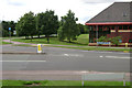
South end of Tachbrook Park Drive, Warwick/Leamington
At its junction with Heathcote Lane. Across the road are the offices of Parker International and Parker Hydraulic Controls. The factory is out of sight behind the offices.
Image: © Robin Stott
Taken: 30 Jul 2009
0.12 miles