
IMAGES TAKEN NEAR TO
Brittain Lane, WARWICK, CV34 6DX
Introduction
This page details the photographs taken nearby to Brittain Lane, CV34 6DX by members of the Geograph project.
The Geograph project started in 2005 with the aim of publishing, organising and preserving representative images for every square kilometre of Great Britain, Ireland and the Isle of Man.

There are currently over 7.5m images from over14,400 individuals and you can help contribute to the project by visiting https://www.geograph.org.uk
Image Map
Images are licensed for reuse under creativecommons.org/licenses/by-sa/2.0
Notes
- Clicking on the map will re-center to the selected point.
- The higher the marker number, the further away the image location is from the centre of the postcode.
Image Listing (91 Images Found)
Images are licensed for reuse under creativecommons.org/licenses/by-sa/2.0
Image
Details
Distance
1
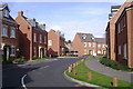
Brittain Lane, Myton
Claustrophobic new development on the site of Trinity School's Dormer Hall.
Trinity has been hugely extended to accommodate the whole school on one site: see Image
Image: © Robin Stott
Taken: 22 Mar 2009
0.03 miles
2
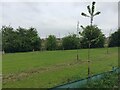
Tree-planted land adjoining new residential development, Myton, Warwick
Two small farms to the south of Warwick and Leamington, Brook Farm and Henry VIII Farm, have finally given in to the developers.
Image: © Robin Stott
Taken: 18 Apr 2020
0.03 miles
3
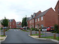
Brittain Lane
Brittain Lane is a brand new housing development just off the Myton Rd the A429 that has roads and verges designed to keep traffic calm. There are chicanes and a large number of wooden posts embedded in the verges to discourage parking.
Image: © Nigel Mykura
Taken: 3 Jul 2011
0.04 miles
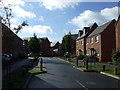
5

Open space, Brook Farm development, Warwick
Brook Farm, one of two small farms in Myton worth millions to developers, finally sold. A new estate has been laid out, its open spaces following the Myton Brook. Compare Image from three years earlier in 2020; the same electricity pylon can be seen on the skyline in both photos.
Photo number 7628050.
Image: © Robin Stott
Taken: 20 Apr 2023
0.04 miles
6
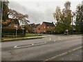
Brittain Lane meets Myton Road, Warwick
This is the turning for Evergreen School, formerly Round Oak School, for children with special needs.
Image id=7421943
Image: © Robin Stott
Taken: 5 Nov 2022
0.05 miles
9
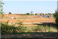
Development site near Brook Farm
This will be housing expansion for Leamington Spa.
Image: © Bill Boaden
Taken: 19 Apr 2019
0.07 miles
10
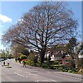
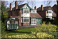
Copper beech, Myton Road, Warwick
This fine copper beech (Fagus sylvatica f. purpurea) stands in a front garden on Myton Road and overhangs the street. It is seen here in April, just as it is coming into bloom and into leaf. Copper beech is an ornamental form of beech with reddish-purple leaves and is often planted as an ornamental tree; see the Woodland Trust site https://www.woodlandtrust.org.uk/trees-woods-and-wildlife/british-trees/a-z-of-british-trees/copper-beech/ .
Image: © A J Paxton
Taken: 20 Apr 2023
0.07 miles