
IMAGES TAKEN NEAR TO
Boswell Grove, WARWICK, CV34 5UP
Introduction
This page details the photographs taken nearby to Boswell Grove, CV34 5UP by members of the Geograph project.
The Geograph project started in 2005 with the aim of publishing, organising and preserving representative images for every square kilometre of Great Britain, Ireland and the Isle of Man.

There are currently over 7.5m images from over14,400 individuals and you can help contribute to the project by visiting https://www.geograph.org.uk
Image Map
Images are licensed for reuse under creativecommons.org/licenses/by-sa/2.0
Notes
- Clicking on the map will re-center to the selected point.
- The higher the marker number, the further away the image location is from the centre of the postcode.
Image Listing (111 Images Found)
Images are licensed for reuse under creativecommons.org/licenses/by-sa/2.0
Image
Details
Distance
1
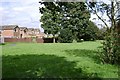
Greenspace to the rear of Corbison Close, Woodloes Park
Looking towards the rear of Lowes Avenue.
Image: © Robin Stott
Taken: 17 Aug 2009
0.04 miles
2
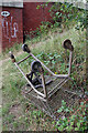
Old shopping trolley by the Grand Union Canal
A little to the west of Image is this shopping trolley - no doubt also pulled out of the canal.
Image: © Stephen McKay
Taken: 11 Aug 2021
0.08 miles
3

Jogging at Cape Bottom Lock, Grand Union Canal, north Warwick
On a bright 2nd of January.
Image: © Robin Stott
Taken: 2 Jan 2017
0.09 miles
4
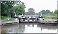
Lock No 24, Grand Union Canal near Warwick
This is the lower of the two wide Cape Locks which lift the water level by 14ft 4in (about 4.4 metres)... and it's raining again.
Image: © Roger D Kidd
Taken: 4 Sep 2008
0.09 miles
5
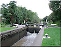
Lock No 24, Grand Union Canal near Warwick
This is the lower of the two Cape Locks which lift the water level by 14ft 4in (about 4.4 metres). The leakage seems to have been improved a bit by August 2009: Image]
Image: © Roger D Kidd
Taken: 4 Sep 2008
0.09 miles
6
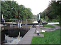
Lock No 24, Grand Union Canal near Warwick
This is the lower of the two Cape Locks which lift the water level by 14ft 4in (about 4.4 metres). The leakage seems to have been improved a bit by August 2009: Image]
Image: © Roger D Kidd
Taken: 4 Sep 2008
0.09 miles
7
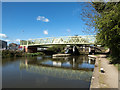
Lock 24 Grand Union Canal
Lock 24 and the footbridge joining Woodloes Estate with Lock Lane.
Image: © David P Howard
Taken: 28 Apr 2015
0.09 miles
8
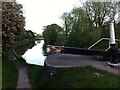
Grand Union Canal looking eastwards from the opposite the Cape of Good Hope public house
The concrete walls surrounding the lock gates reflect the redevelopment of the canal in the 1930s by the Grand Union Canal, which had taken it over from the failing Warwick & Napton Canal. https://www.ourwarwickshire.org.uk/content/catalogue_her/the-warwick-and-birmingham-canal One of a pair of locks on this otherwise level section of canal in Warwick & Leamington.
Image: © A J Paxton
Taken: 29 May 2021
0.09 miles
9
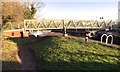
Footbridge over the Grand Union Canal, Cape Bottom Lock, north Warwick
It connects Lock Lane on the south side (right) with the southwest corner of the Woodloes estate on the north side (left). From below the lock it looks like this: Image
Image: © Robin Stott
Taken: 2 Jan 2017
0.09 miles
10
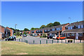
Exham Close, Woodloes Park
Suburban housing on the north side of Warwick. An area of short residential streets and cul de sacs.
Image: © Des Blenkinsopp
Taken: 27 Jun 2018
0.09 miles