
IMAGES TAKEN NEAR TO
The Ridgeway, WARWICK, CV34 5SH
Introduction
This page details the photographs taken nearby to The Ridgeway, CV34 5SH by members of the Geograph project.
The Geograph project started in 2005 with the aim of publishing, organising and preserving representative images for every square kilometre of Great Britain, Ireland and the Isle of Man.

There are currently over 7.5m images from over14,400 individuals and you can help contribute to the project by visiting https://www.geograph.org.uk
Image Map
Images are licensed for reuse under creativecommons.org/licenses/by-sa/2.0
Notes
- Clicking on the map will re-center to the selected point.
- The higher the marker number, the further away the image location is from the centre of the postcode.
Image Listing (218 Images Found)
Images are licensed for reuse under creativecommons.org/licenses/by-sa/2.0
Image
Details
Distance
1
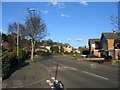
Spinney Hill, Warwick
Early evening in North Warwick.
Image: © David Stowell
Taken: 18 Apr 2005
0.06 miles
2
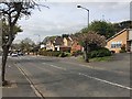
Northwest on Spinney Hill, Warwick
The straight bit. Spinney Hill-Greville Road form a busy distributor road through Warwick's northeastern estates.
Image: © Robin Stott
Taken: 9 Apr 2019
0.07 miles
3

Wall Barley, Warwick
Wall Barley (Hordeum murinum) is a common weed. No wall? Anywhere will do. Location: Spinney Hill and everywhere else. However, a large unmown area in full flower is an attractive sight Image
Photo number 8362418.
Image: © Robin Stott
Taken: 15 Jun 2026
0.08 miles
4
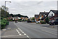
East up Spinney Hill, Warwick
This photo reproduces the first Geograph for this square: Image, taken by David Stowell on a sunny 18th of April 2005. The view is wider-angle than David's but the viewpoint is the same, the corner of Lilac Grove. Spinney Hill and Greville Road form a racetrack distributor through northeast Warwick. The street trees in David's view along with others have been removed recently.
old-maps.co.uk shows that development north of the canal, both industry and residential, proceeded slowly from around 1900. The Spinney Hill estates, private and local authority, were in place on a map of 1968-71. Woodloes Park to the west was developed later, between the mid-1970s and the early 1980s. Blacklow Spinney, that gives the area its name and is seen in the background, first appears on a map of 1925 as mixed woodland. Today it is a local nature reserve.
Image: © Robin Stott
Taken: 10 Sep 2020
0.08 miles
5
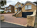
Extended house, Spinney Hill, Warwick
It is possible that two neighbouring houses have been connected by extensions.
Image: © Robin Stott
Taken: 18 Aug 2021
0.08 miles
6

All Saints Junior School entrance, Nelson Avenue
This is All Saints Church of England Junior School.
Image: © Robin Stott
Taken: 27 Dec 2012
0.08 miles
7
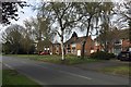
Semi-detached houses, north end of Montague Road, Warwick
Image: © Robin Stott
Taken: 9 Apr 2019
0.09 miles
8
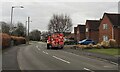
Grocery deliveries, Montague Road, Warwick
Deliveries have become a more frequent sight during the pandemic.
Image: © Robin Stott
Taken: 4 Mar 2021
0.09 miles
9
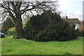
Yew tree, former Ridgeway School site, Montague Road, Warwick
What caught my attention about this tree was the drooping shoots. However, it was in flower: perhaps the weight of the flowers caused the young shoots to bend. Shoots and flowers: Image
Image: © Robin Stott
Taken: 9 Apr 2019
0.09 miles
10
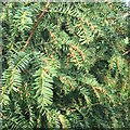
Flowering shoots of yew, former Ridgeway School site, Montague Road, Warwick
Tree: Image
Image: © Robin Stott
Taken: 9 Apr 2019
0.09 miles