
IMAGES TAKEN NEAR TO
Greenway, WARWICK, CV34 5SG
Introduction
This page details the photographs taken nearby to Greenway, CV34 5SG by members of the Geograph project.
The Geograph project started in 2005 with the aim of publishing, organising and preserving representative images for every square kilometre of Great Britain, Ireland and the Isle of Man.

There are currently over 7.5m images from over14,400 individuals and you can help contribute to the project by visiting https://www.geograph.org.uk
Image Map
Images are licensed for reuse under creativecommons.org/licenses/by-sa/2.0
Notes
- Clicking on the map will re-center to the selected point.
- The higher the marker number, the further away the image location is from the centre of the postcode.
Image Listing (99 Images Found)
Images are licensed for reuse under creativecommons.org/licenses/by-sa/2.0
Image
Details
Distance
3
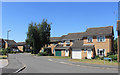
Greenway, Woodloes Park
Suburban housing on the north side of Warwick. An area of short residential streets and cul de sacs.
Image: © Des Blenkinsopp
Taken: 27 Jun 2018
0.03 miles
4
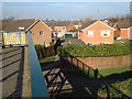
Scar Bank footbridge and footpath from Greenway
Image: © Robin Stott
Taken: 1 Mar 2012
0.03 miles
5
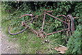
Old bicycle by the Grand Union Canal
The rusty remains of a bicycle lie by the towpath close to bridge 49A. It has probably been fished out of the water.
Image: © Stephen McKay
Taken: 11 Aug 2021
0.05 miles
6
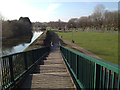
Stepped ramp, Scar Bank footbridge
I would guess that there was not space for both a long ramp and a flight of steps to this footbridge. A stepped ramp or perron is a compromise. The risers are commonly 10cm or less. This discourages cyclists and skateboarders, is manageable for a pushchair, although almost impossible for a self-propelled wheelchair.
Image: © Robin Stott
Taken: 1 Mar 2012
0.05 miles
7
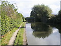
Grand Union Canal Walk
Grand Union Canal Walk at Woodloes Park Footbridge
Image: © Shaun Ferguson
Taken: 11 Oct 2016
0.05 miles
8
![Warwick bridges [4]](https://s2.geograph.org.uk/geophotos/06/62/92/6629282_99ee2e9b_120x120.jpg)
Warwick bridges [4]
The footbridge over the Grand Union Canal connects Millers Road and Scar Bank to the Woodloes Park housing estate.
A market town and county town of Warwickshire, Warwick lies on the River Avon, 11 miles (18 kilometres) south of Coventry. There is evidence of unbroken habitation from the 6th century AD with signs of Neolithic and Roman activity before that date. It was a Saxon burh in the 9th century and Warwick Castle was built during the Norman Conquest. Much of the town was destroyed in The Great Fire of Warwick in 1694. Warwick Racecourse is located just west of the town centre. The Grand Union Canal passes through the town and the restored Saltisford Canal Arm is close to the town centre.
Image: © Michael Dibb
Taken: 4 Aug 2020
0.05 miles
9
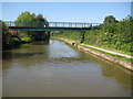
Grand Union Canal: Bridge Number 49A: Woodloes Park Footbridge
Canal bridges numbered with a suffix indicate new structures built after the original numbering scheme was devised. This modern footbridge gives access over the canal between the large modern Woodloes Park housing estate to the right and north and the industrial areas and Warwick Hospital to the left and south.
Image: © Nigel Cox
Taken: 5 Sep 2012
0.06 miles
10
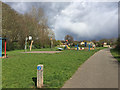
Canalside playspace, Woodloes estate, north Warwick
The relationship to the canal is shown in a view from 2009: Image In 2016 it was a day of wintry showers.
Image: © Robin Stott
Taken: 16 Apr 2016
0.06 miles