
IMAGES TAKEN NEAR TO
St. Marys Close, WARWICK, CV34 5RU
Introduction
This page details the photographs taken nearby to St. Marys Close, CV34 5RU by members of the Geograph project.
The Geograph project started in 2005 with the aim of publishing, organising and preserving representative images for every square kilometre of Great Britain, Ireland and the Isle of Man.

There are currently over 7.5m images from over14,400 individuals and you can help contribute to the project by visiting https://www.geograph.org.uk
Image Map
Images are licensed for reuse under creativecommons.org/licenses/by-sa/2.0
Notes
- Clicking on the map will re-center to the selected point.
- The higher the marker number, the further away the image location is from the centre of the postcode.
Image Listing (103 Images Found)
Images are licensed for reuse under creativecommons.org/licenses/by-sa/2.0
Image
Details
Distance
1
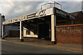
Warwick Batteries on Birmingham Road
Although this is now the A425 the road name gives away it is all part of what was the A41 and still goes to Birmingham on the same route.
Image: © David Howard
Taken: 1 Aug 2021
0.02 miles
2
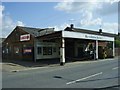
Warwick-Birmingham Road
Premises for tyre and battery services.
Image: © Ian Rob
Taken: 16 Apr 2011
0.02 miles
3
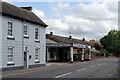
Birmingham Road, Warwick
This is a stretch of the A425 heading towards the town centre. Warwick Batteries is a well-established business here supplying vehicle batteries.
Image: © Stephen McKay
Taken: 11 Aug 2021
0.02 miles
4
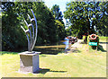
The End of the Saltisford Arm
Originally part of the canal main line but bypassed by new alignments, the Saltisford branch became derelict, but is now restored as the Saltisford Canal Centre providing secure moorings in a very pleasant setting. This is as far as it goes, with an artistic thingy at the end.
Image: © Des Blenkinsopp
Taken: 27 Jun 2018
0.03 miles
5
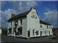
Warwick-The Dun Cow
Public House on Birmingham Road.
Image: © Ian Rob
Taken: 16 Apr 2011
0.03 miles
6
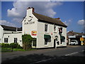
The Dun Cow Pub, Warwick
Birmingham Road WARWICK CV34 5RH next to The Saltisford Arm, Grand Union Canal.
Image: © canalandriversidepubs co uk
Taken: 4 Jun 2010
0.03 miles
7
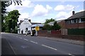
Birmingham Road, Warwick
According to local legend, the Dun Cow was a ravening beast slain by Guy of Warwick.
Image: © Robin Stott
Taken: 13 Jul 2009
0.03 miles
8
![Warwick bridges [1]](https://s0.geograph.org.uk/geophotos/06/62/92/6629256_65f4b6a1_120x120.jpg)
Warwick bridges [1]
The bridge carries the Chiltern Line railway over the A425 road which is named Saltisford on this side of the bridge and Birmingham Road beyond.
A market town and county town of Warwickshire, Warwick lies on the River Avon, 11 miles (18 kilometres) south of Coventry. There is evidence of unbroken habitation from the 6th century AD with signs of Neolithic and Roman activity before that date. It was a Saxon burh in the 9th century and Warwick Castle was built during the Norman Conquest. Much of the town was destroyed in The Great Fire of Warwick in 1694. Warwick Racecourse is located just west of the town centre. The Grand Union Canal passes through the town and the restored Saltisford Canal Arm is close to the town centre.
Image: © Michael Dibb
Taken: 4 Aug 2020
0.04 miles
9

Footpath through Diamond Jubilee Wood
A footpath along the northern edge of Diamond Jubilee Wood, with the railway line on the right behind the fence.
Image: © David P Howard
Taken: 28 Apr 2015
0.05 miles
10
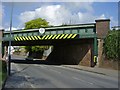
Warwick-Birmingham Road
The line to Birmingham crosses at this point.
Image: © Ian Rob
Taken: 16 Apr 2011
0.07 miles