
IMAGES TAKEN NEAR TO
Dale Close, WARWICK, CV34 5NA
Introduction
This page details the photographs taken nearby to Dale Close, CV34 5NA by members of the Geograph project.
The Geograph project started in 2005 with the aim of publishing, organising and preserving representative images for every square kilometre of Great Britain, Ireland and the Isle of Man.

There are currently over 7.5m images from over14,400 individuals and you can help contribute to the project by visiting https://www.geograph.org.uk
Image Map
Images are licensed for reuse under creativecommons.org/licenses/by-sa/2.0
Notes
- Clicking on the map will re-center to the selected point.
- The higher the marker number, the further away the image location is from the centre of the postcode.
Image Listing (278 Images Found)
Images are licensed for reuse under creativecommons.org/licenses/by-sa/2.0
Image
Details
Distance
1
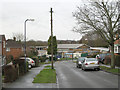
Nelson Avenue
A short residential road off George Road. The turning on the left is Dale Close. At the end of the street (in SP2966) is All Saints C of E Junior School.
Image: © Robin Stott
Taken: 27 Dec 2012
0.04 miles
2
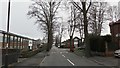
Montague Road, Warwick
Where suburbia and light industry sit in close proximity.
Image: © Stuart Shepherd
Taken: 1 Apr 2018
0.05 miles
3
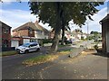
George Road, Emscote, Warwick
Only Charles Street and part of All Saints Road are shown on a map of 1938. The eastern end of Montague Road is shown dotted. It's a reasonable guess that industry along the road developed during World War II. By 1955 a map shows the southern half of George Road and the eastern half of Montague Road built up. The lime trees pictured are shedding leaves and fruit.
Image: © Robin Stott
Taken: 8 Sep 2020
0.05 miles
4
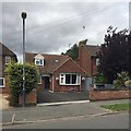
Front garden, George Road, Warwick
Parking trumps planting.
Image: © Robin Stott
Taken: 10 Jul 2019
0.05 miles
5
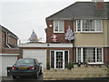
Outdoor Christmas decorations, George Road
Christmas is acknowledged by two white plastic Christmas trees and Santa with sledge on the flat roof of a porch and garage extension.
Image: © Robin Stott
Taken: 27 Dec 2012
0.05 miles
6

All Saints Junior School entrance, Nelson Avenue
This is All Saints Church of England Junior School.
Image: © Robin Stott
Taken: 27 Dec 2012
0.06 miles
7
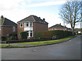
Detached corner house, George Road
Both George Road and Nelson Avenue, right, are lined with semi-detached houses, except on this corner.
Image: © Robin Stott
Taken: 27 Dec 2012
0.06 miles
8
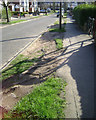
Wear and tear, grass verge, George Road, Warwick
Residents are forced to park half on the verge to ensure a clear run for vehicles and avoid scrapes. This is a headache for local authorities. The damaged verge is unsightly but paving it takes away a bit of green that contributes to the character to the street.
Image: © Robin Stott
Taken: 11 Mar 2014
0.06 miles
9
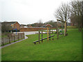
Play areas, All Saints Junior School, Nelson Avenue
Viewed through the security fence by the entrance at the end of Nelson Avenue. The fence to the left encloses staff parking spaces, with the school buildings further off to the left.
Image: © Robin Stott
Taken: 27 Dec 2012
0.06 miles
10
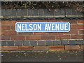
Nelson Avenue nameplate 2
A earlier-twentieth century nameplate using a condensed grotesque sans-serif typeface, not unlike Franklin Gothic Extra Condensed. Notice the closure of the space between the A and the V, an example of kerning that was perhaps a little overdone. Compare Image
Image: © Robin Stott
Taken: 27 Dec 2012
0.06 miles