
IMAGES TAKEN NEAR TO
Wharf Street, WARWICK, CV34 5LB
Introduction
This page details the photographs taken nearby to Wharf Street, CV34 5LB by members of the Geograph project.
The Geograph project started in 2005 with the aim of publishing, organising and preserving representative images for every square kilometre of Great Britain, Ireland and the Isle of Man.

There are currently over 7.5m images from over14,400 individuals and you can help contribute to the project by visiting https://www.geograph.org.uk
Image Map
Images are licensed for reuse under creativecommons.org/licenses/by-sa/2.0
Notes
- Clicking on the map will re-center to the selected point.
- The higher the marker number, the further away the image location is from the centre of the postcode.
Image Listing (469 Images Found)
Images are licensed for reuse under creativecommons.org/licenses/by-sa/2.0
Image
Details
Distance
1
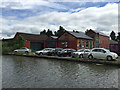
Converted industrial buildings off Wharf Street, Warwick
The narrow strip of land between Wharf Street and the canal was solid with industry in the past. Some buildings have been replaced, some converted. The uses are now light industry, workshops and retail.
Image: © Robin Stott
Taken: 17 Jun 2015
0.00 miles
2

The Wharf Centre, Wharf Street, Warwick, seen from the Grand Union Canal
One of many former industrial and warehouse premises in this district of Warwick that is now let to small businesses.
Image: © A J Paxton
Taken: 29 May 2021
0.01 miles
3

Charles Street, Warwick
A street that keeps changing character along its 500 metre length.
Image: © Robin Stott
Taken: 15 Mar 2009
0.01 miles
4

Canalside, Wharf Street businesses, Warwick
On the left is Bridge 38, Charles Street.
Image: © Robin Stott
Taken: 7 Mar 2021
0.01 miles
5
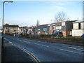
Retail warehouses, Wharf Street
Normally busy, these businesses are closed or quiet on the day after Boxing Day.
Image: © Robin Stott
Taken: 27 Dec 2012
0.02 miles
6

Retail sheds, Wharf Street, Warwick
Two of the eight. Customers come and go, mostly by car. The former factory and warehouses beyond are occupied by flats and businesses; there is the Emscote Lawn residential estate across the road. Perhaps there are enough people around to support the snack van.
Image: © Robin Stott
Taken: 3 Feb 2023
0.02 miles
7

Grand Union Canal: Reach in Emscote
Industrial buildings line the canal on either side through this reach, although the development on the south, left side, of the canal is 19th century, while on the north, right side, it is very much mid-20th century.
Image: © Nigel Cox
Taken: 5 Sep 2012
0.02 miles

9

Grand Union Canal: Emscote Mills
Emscote Mills were originally built for the production of gelatine. There is a comprehensive illustrated website about the mills here http://www.mirrormist.com/nelsons_gelatine_1950s.htm
Image: © Nigel Cox
Taken: 5 Sep 2012
0.02 miles
10
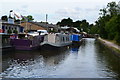
Boatyard beside the Grand Union Canal near bridge No 48
Image: © David Martin
Taken: 21 Jul 2016
0.03 miles