
IMAGES TAKEN NEAR TO
Nicholson Close, WARWICK, CV34 5HE
Introduction
This page details the photographs taken nearby to Nicholson Close, CV34 5HE by members of the Geograph project.
The Geograph project started in 2005 with the aim of publishing, organising and preserving representative images for every square kilometre of Great Britain, Ireland and the Isle of Man.

There are currently over 7.5m images from over14,400 individuals and you can help contribute to the project by visiting https://www.geograph.org.uk
Image Map
Images are licensed for reuse under creativecommons.org/licenses/by-sa/2.0
Notes
- Clicking on the map will re-center to the selected point.
- The higher the marker number, the further away the image location is from the centre of the postcode.
Image Listing (59 Images Found)
Images are licensed for reuse under creativecommons.org/licenses/by-sa/2.0
Image
Details
Distance
1
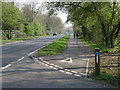
A429 Coventry Road, Warwick
Recently blessed with a cycleway. The footpath from Millbank emerges, left. Image
Woodloes Lane, aka Sandy Lane, goes off to the right. Image
Image: © Robin Stott
Taken: 3 Apr 2009
0.04 miles
2
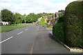
Nicholson Close, Woodloes Park, Warwick
Image: © Robin Stott
Taken: 17 Aug 2009
0.04 miles
3
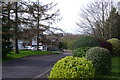
Larch Grove, Warwick
Larch Grovem, complete with larches, looks out over the former Guy's Cliffe estate.
Image: © Robin Stott
Taken: 31 Mar 2009
0.05 miles
4

Coventry Road spinney, Warwick
Alongside the Coventry Road but separated from it by an old estate wall is a strip of council-owned woodland, mostly ash, which is managed as a Local Nature Reserve.
Image: © Robin Stott
Taken: 3 Apr 2009
0.05 miles
6
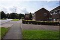
Paddock by Woodloes Lane, Warwick
Over the hedge, right, is the sales building of an independent nursery adjoining Coventry Road.
Image: © Robin Stott
Taken: 15 Nov 2009
0.09 miles
7
Coventry Road island, Warwick
A major node on the local road network. Blacklow Road climbs a hill in the distance.
Image: © Robin Stott
Taken: 31 Mar 2009
0.11 miles
8
Coventry Road approaching Warwick
A busy junction: Primrose Hill comes in from Woodloes Park to the right; Spinney Hill is to the left.
Image: © Robin Stott
Taken: 21 Sep 2020
0.11 miles
9
Roundabout on Coventry Road
The roundabout gives access to a lot of housing on the north side of Warwick.
Image: © Bill Boaden
Taken: 19 Apr 2019
0.12 miles
10
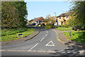
Blacklow Road
The beginning of a road leading round the northern edge of Warwick.
Image: © Bill Boaden
Taken: 19 Apr 2019
0.13 miles