
IMAGES TAKEN NEAR TO
Portobello Way, WARWICK, CV34 5FX
Introduction
This page details the photographs taken nearby to Portobello Way, CV34 5FX by members of the Geograph project.
The Geograph project started in 2005 with the aim of publishing, organising and preserving representative images for every square kilometre of Great Britain, Ireland and the Isle of Man.

There are currently over 7.5m images from over14,400 individuals and you can help contribute to the project by visiting https://www.geograph.org.uk
Image Map
Images are licensed for reuse under creativecommons.org/licenses/by-sa/2.0
Notes
- Clicking on the map will re-center to the selected point.
- The higher the marker number, the further away the image location is from the centre of the postcode.
Image Listing (269 Images Found)
Images are licensed for reuse under creativecommons.org/licenses/by-sa/2.0
Image
Details
Distance
1

Development at Pottertons' site
This is part of the 25 acre site beside the River Avon occupied for over 100 years by Pottertons. Following company mergers production ceased and the site was closed at the turn of this century. It is currently being redeveloped as "Waterside" with blocks of flats and some lower rise housing. The concrete foundations to a further phase of the development can be seen here, just into the adjacent square.
Image: © David Stowell
Taken: 18 Mar 2009
0.01 miles
2
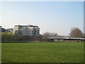
Waterside
The blocks of flats on the site of the former Potterton's factory and the new bridge over the River Avon as seen from Rugby Road. The flood plain in the foreground was used as sports fields by Potterton's social club.
Image: © David Stowell
Taken: 18 Mar 2009
0.01 miles
3
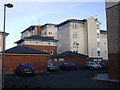
The Waterfront, Warwick
Blocks of flats and garages in assorted sizes, seen from the new Portobello Way at the rear of Greville Road.
Image: © Robin Stott
Taken: 14 Mar 2009
0.01 miles
4
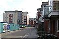
The Waterfront, Warwick
The view down the unfinished Kempton Drive towards the big block of the development.
Image: © Robin Stott
Taken: 15 Mar 2009
0.01 miles
5
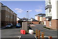
Social divide, The Waterfront, Warwick
Social housing, quickly occupied, left. Flats for sale, half-empty, right.
Image: © Robin Stott
Taken: 29 Mar 2009
0.01 miles
6
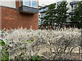
Webs on shrubs, Waterfront estate, Warwick
It is understood that these webs are spun by Ermine Moth caterpillars to protect themselves from predators while they eat the leaves. The shrub bed is at the junction of Sir Anthony Eden Way and Kempton Drive.
Image ID: 7349829
Update, May 2023: the plants have recovered Image
Image: © Robin Stott
Taken: 2 Jun 2022
0.03 miles
7

Social housing, Portobello Way, Warwick
The Waterfront development http://www.geograph.org.uk/photo/1227045 on the site of Potterton's boiler factory has created this new street behind blocks of upmarket flats.
Before, it was a humdrum rear access to houses in Greville Road, right, now tidied up somewhat.
The social housing was quickly occupied.
[Gazetteer line is nonsense. This site is in Warwick and has no connection with Old Milverton]
Image: © Robin Stott
Taken: 14 Mar 2009
0.03 miles
8
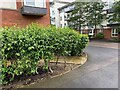
Living shrubs, Waterfront estate, Warwick
These are the shrubs that were photographed covered in webbing in June 2022: Image Their leaves had been eaten by Ermine Moth caterpillars who had protected themselves from predators by spinning webs. In a recent visit to the scene curiosity about the shrubs' fate gave way to astonishment at finding the plants recovered and in full leaf. They may be a species of Euonymus (Spindle) – time will tell.
Image ID: 7479945.
Image: © Robin Stott
Taken: 9 May 2023
0.03 miles
9

Portobello Way, Emscote, Warwick
The houses along Portobello Way are the social housing element of the Waterfront development Image The road also serves the rear of Greville Road: it offers examples of the size that 'fast-growing conifers' can attain. Portobello Way continues as a track to the Percy Estate allotments (formerly Pottertons) and a terminal tower taking power lines underground Image
Image: © Robin Stott
Taken: 14 Jun 2021
0.04 miles
10

The Waterfront development, Warwick, seen from Rock Mill Lane, Leamington
Sir Anthony Eden Way, right, crosses the River Avon and leads to the area of flats for private sale built on the former Potterton's site. A new open space has been laid out on what was Potterton's sports field. It is liable to flooding. Anthony Eden was the Tory MP for Warwick and Leamington, 1923-1957. Pottertons made domestic boilers.
Image: © Robin Stott
Taken: 29 Nov 2018
0.04 miles