
IMAGES TAKEN NEAR TO
Green Lane, WARWICK, CV34 5BP
Introduction
This page details the photographs taken nearby to Green Lane, CV34 5BP by members of the Geograph project.
The Geograph project started in 2005 with the aim of publishing, organising and preserving representative images for every square kilometre of Great Britain, Ireland and the Isle of Man.

There are currently over 7.5m images from over14,400 individuals and you can help contribute to the project by visiting https://www.geograph.org.uk
Image Map
Images are licensed for reuse under creativecommons.org/licenses/by-sa/2.0
Notes
- Clicking on the map will re-center to the selected point.
- The higher the marker number, the further away the image location is from the centre of the postcode.
Image Listing (260 Images Found)
Images are licensed for reuse under creativecommons.org/licenses/by-sa/2.0
Image
Details
Distance
1
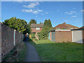
Footpath between Vine Lane and Green Lane, Warwick
Image: © Robin Stott
Taken: 16 Jan 2022
0.02 miles
2
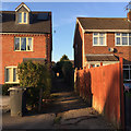
Footpath to Green Lane from Vine Lane, Packmores, Warwick
The house on the left was recently built on the site of The Vine public house. Green Lane is an unadopted residential road to the south of Warwick Hospital.
Image: © Robin Stott
Taken: 26 Nov 2016
0.03 miles
3
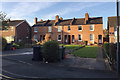
Terrace of five houses, Vine Lane, Packmores, Warwick
Vine Lane developed piecemeal; this terrace first appears on an OS map of 1925, and is named Vine Cottages on a map of 1952. Later houses are nearer the road but have longer rear gardens. The Vine public house was next door to the pair of houses on the left.
Image: © Robin Stott
Taken: 26 Nov 2016
0.03 miles
4
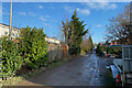
East on Green Lane, Warwick
Green Lane is an unadopted residential road with a boundary to Warwick Hospital.
Image: © Robin Stott
Taken: 16 Jan 2022
0.04 miles
5
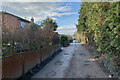
West on Green Lane, Warwick
Green Lane is an unadopted residential road with a boundary to Warwick Hospital.
Image: © Robin Stott
Taken: 16 Jan 2022
0.04 miles
6
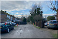
West end of Green Lane, Warwick
Green Lane is an unadopted road with a boundary to Warwick Hospital.
Image: © Robin Stott
Taken: 16 Jan 2022
0.04 miles
7
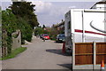
Green Lane, Warwick
Looking back up this private or unadopted road towards Lakin Road.
There is a boundary, left, with Warwick Hospital for most of the length of the road - some 250 metres.
Image: © Robin Stott
Taken: 14 Apr 2009
0.05 miles
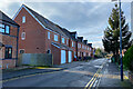
9
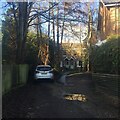
Two cottages off Vine Lane, Warwick
They are appealing and oddly-sited, like a couple of other properties in the backland of Vine Lane and the rear of Green Lane, an unadopted residential road.
Image: © Robin Stott
Taken: 16 Jan 2021
0.06 miles
10
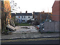
Vacant plot, Vine Lane, Packmores, Warwick
Image: © Robin Stott
Taken: 26 Nov 2016
0.07 miles