
IMAGES TAKEN NEAR TO
Romani Close, WARWICK, CV34 4TY
Introduction
This page details the photographs taken nearby to Romani Close, CV34 4TY by members of the Geograph project.
The Geograph project started in 2005 with the aim of publishing, organising and preserving representative images for every square kilometre of Great Britain, Ireland and the Isle of Man.

There are currently over 7.5m images from over14,400 individuals and you can help contribute to the project by visiting https://www.geograph.org.uk
Image Map
Images are licensed for reuse under creativecommons.org/licenses/by-sa/2.0
Notes
- Clicking on the map will re-center to the selected point.
- The higher the marker number, the further away the image location is from the centre of the postcode.
Image Listing (112 Images Found)
Images are licensed for reuse under creativecommons.org/licenses/by-sa/2.0
Image
Details
Distance
2
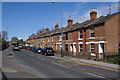
Traditional housing in Warwick
A terrace of traditional housing in Warwick.
Image: © Colin Craig
Taken: 7 Apr 2009
0.02 miles
3
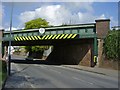
Warwick-Birmingham Road
The line to Birmingham crosses at this point.
Image: © Ian Rob
Taken: 16 Apr 2011
0.03 miles
4
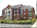
The Spires Flats, Warwick
Apartment building in Warwick
Image: © David Walton
Taken: 1 Aug 2007
0.03 miles
5
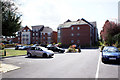
New housing, Warwick
These blocks of flats and detached houses now cover what was the site and grounds of Hill House, a large possibly 19th century villa demolished a few years ago to allow this development to go ahead.
Image: © Colin Craig
Taken: 7 Apr 2009
0.04 miles
6
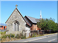
Old Chapel next to the Mormon Church
The building with the white spire is a modern church belonging to the Latter Day Saints, but the old chapel in front doesn't seem to be used for anything
Image: © Des Blenkinsopp
Taken: 27 Jun 2018
0.04 miles
7
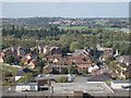
Housing off Saltisford A425
Below centre in the picture is a mixed residential development on the site of the Cape Environmental works. I believe they made asbestos-cement roofing tiles. In the distance is another residential estate, on the site of the King Edward VII Memorial Hospital – a tuberculosis sanatorium. The view is across the roof of the county council's Barrack Street offices and the Sainsbury's supermarket down the hill. At right centre a CrossCountry service between the northeast and the south coast crosses Saltisford. The view is from the tower of St Mary's Church.
Image: © Robin Stott
Taken: 15 Oct 2011
0.04 miles
9
![Warwick buildings [132]](https://s1.geograph.org.uk/geophotos/06/62/87/6628701_a6dad405_120x120.jpg)
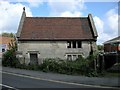
Warwick buildings [132]
This modest building, numbers 108 and 108A Saltisford, was the chapel for the Leper Hospital of Saint Michael. The hospital was founded in the 12th century and this building is 15th century built on the foundations of its 12th century predecessor. The building was added to and converted into two cottages in the 18th century. This and The Masters House Image form one of the very few leper hospitals of the early middle ages still surviving. The chapel is listed, grade II*, with details at: https://historicengland.org.uk/listing/the-list/list-entry/1035366 The site is a Scheduled Ancient Monument and details are at: https://historicengland.org.uk/listing/the-list/list-entry/1011035
A market town and county town of Warwickshire, Warwick lies on the River Avon, 11 miles (18 kilometres) south of Coventry. There is evidence of unbroken habitation from the 6th century AD with signs of Neolithic and Roman activity before that date. It was a Saxon burh in the 9th century and Warwick Castle was built during the Norman Conquest. Much of the town was destroyed in The Great Fire of Warwick in 1694. Warwick Racecourse is located just west of the town centre. The Grand Union Canal passes through the town and the restored Saltisford Canal Arm is close to the town centre.
Image: © Michael Dibb
Taken: 4 Aug 2020
0.04 miles
10
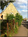
Saltisford with St. Michael's Chapel
Saltisford is a historic suburb of Warwick stretching along the road to Birmingham. This photo shows the view towards Warwick town centre, with the tower of St. Mary's visible on the hilltop. St. Michael's chapel, on the left, is a listed building on the site of a scheduled ancient monument, St. Michael's Leper Hospital. The church of St. Michael was founded in 1135 and the hospital first appears in the records in 1275. Medieval leper hospitals isolated the sufferers from society and, like other hospitals of the period, offered spiritual more than medical care. Most were suppressed at the Reformation along with the monasteries and chantry chapels which had supported them, and St Michael's hospital is described as being in a ruinous state in 1540. Since then the site has been in private ownership, with the two surviving buildings, the chapel and the house known as the Master's House, used as cottages and, more recently, left derelict. https://historicengland.org.uk/listing/the-list/list-entry/1011035 Warwick District Council served a compulsory purchase order on the site in January 2021. https://www.warwickcourier.co.uk/news/people/council-serves-compulsory-purchase-order-warwicks-medieval-leper-hospital-3101841
Image: © A J Paxton
Taken: 29 May 2021
0.04 miles