
IMAGES TAKEN NEAR TO
The Butts, WARWICK, CV34 4ST
Introduction
This page details the photographs taken nearby to The Butts, CV34 4ST by members of the Geograph project.
The Geograph project started in 2005 with the aim of publishing, organising and preserving representative images for every square kilometre of Great Britain, Ireland and the Isle of Man.

There are currently over 7.5m images from over14,400 individuals and you can help contribute to the project by visiting https://www.geograph.org.uk
Image Map
Images are licensed for reuse under creativecommons.org/licenses/by-sa/2.0
Notes
- Clicking on the map will re-center to the selected point.
- The higher the marker number, the further away the image location is from the centre of the postcode.
Image Listing (1488 Images Found)
Images are licensed for reuse under creativecommons.org/licenses/by-sa/2.0
Image
Details
Distance
1
![Warwick houses [115]](https://s0.geograph.org.uk/geophotos/06/62/38/6623880_e4e6b1d2_120x120.jpg)
Warwick houses [115]
This terrace of four houses, odd numbers 19 to 25 The Butts is dated 1787. Built in red brick on a stone plinth with stone quoins. Listed, grade II, with details at: https://historicengland.org.uk/listing/the-list/list-entry/1364791
A market town and county town of Warwickshire, Warwick lies on the River Avon, 11 miles (18 kilometres) south of Coventry. There is evidence of unbroken habitation from the 6th century AD with signs of Neolithic and Roman activity before that date. It was a Saxon burh in the 9th century and Warwick Castle was built during the Norman Conquest. Much of the town was destroyed in The Great Fire of Warwick in 1694. Warwick Racecourse is located just west of the town centre. The Grand Union Canal passes through the town and the restored Saltisford Canal Arm is close to the town centre.
Image: © Michael Dibb
Taken: 6 Aug 2020
0.00 miles
2
![Warwick ways [1]](https://s3.geograph.org.uk/geophotos/06/62/38/6623879_98aeb7d5_120x120.jpg)
Warwick ways [1]
From The Butts this footpath named 'Tik a Tank' runs alongside the garden wall of The Deanery to the churchyard of St Mary to Church Street.
A market town and county town of Warwickshire, Warwick lies on the River Avon, 11 miles (18 kilometres) south of Coventry. There is evidence of unbroken habitation from the 6th century AD with signs of Neolithic and Roman activity before that date. It was a Saxon burh in the 9th century and Warwick Castle was built during the Norman Conquest. Much of the town was destroyed in The Great Fire of Warwick in 1694. Warwick Racecourse is located just west of the town centre. The Grand Union Canal passes through the town and the restored Saltisford Canal Arm is close to the town centre.
Image: © Michael Dibb
Taken: 6 Aug 2020
0.01 miles
3
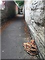
Fungus by the Tink-a-Tank, Warwick
This may be related to old trees in the public garden on the other side of the wall.
Image: © Robin Stott
Taken: 29 Jul 2020
0.01 miles
4
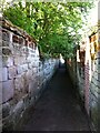
Footpath known as Tink-a-tank
Tink-a-tank runs between Church Street and the Butts, through St. Mary's churchyard. It takes its name from the sound of footfalls echoing between its sandstone walls. The photo shows the stretch from the churchyard to the Butts.
Image: © A J Paxton
Taken: 29 May 2021
0.01 miles
5
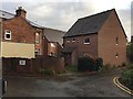
Houses at the rear of The Butts, Warwick
An infill development of one or two houses completely out of sight from the main road.
Image: © Robin Stott
Taken: 3 Dec 2018
0.01 miles
6
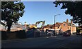
All done for today: demolition by The Butts, Warwick
King's High School for Girls having moved to the Warwick School site, a modern teaching block has been demolished, no doubt to make way for new residential development: compare Image
Image: © Robin Stott
Taken: 17 Sep 2020
0.02 miles
7
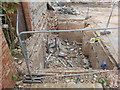
Partial Demolition of (Old) Kings High School, Warwick - 21.8.20
Image: © Geoff Ousbey
Taken: 21 Aug 2020
0.02 miles
8
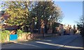
Southeast and downhill on The Butts, Warwick
Most of these properties are presumed empty. They were occupied by King's High School for Girls before its move to Myton Image
Image: © Robin Stott
Taken: 29 Oct 2018
0.02 miles
9
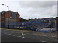
Partial Demolition of (Old) Kings High School, Warwick - 21.8.20
Image: © Geoff Ousbey
Taken: 21 Aug 2020
0.02 miles
10
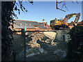
Demolitions in progress, former King's High School for Girls, The Butts, Warwick
The buildings that have gone are those behind the trees in Image Guessing, they were all post-war and perhaps did not lend themselves to conversion to flats. The building in the background has a frontage to Chapel Street: Image
Image: © Robin Stott
Taken: 17 Sep 2020
0.03 miles