
IMAGES TAKEN NEAR TO
Maynard Avenue, WARWICK, CV34 4PU
Introduction
This page details the photographs taken nearby to Maynard Avenue, CV34 4PU by members of the Geograph project.
The Geograph project started in 2005 with the aim of publishing, organising and preserving representative images for every square kilometre of Great Britain, Ireland and the Isle of Man.

There are currently over 7.5m images from over14,400 individuals and you can help contribute to the project by visiting https://www.geograph.org.uk
Image Map
Images are licensed for reuse under creativecommons.org/licenses/by-sa/2.0
Notes
- Clicking on the map will re-center to the selected point.
- The higher the marker number, the further away the image location is from the centre of the postcode.
Image Listing (1443 Images Found)
Images are licensed for reuse under creativecommons.org/licenses/by-sa/2.0
Image
Details
Distance
1
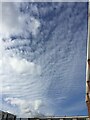
Cumulus and altocumulus clouds over Warwick
Cumulus: 'cottonwool' clouds on the left: their bases can be between 400 and 2,000 metres above the earth.
Altocumulus on the right: their bases can be between 1,500 and 6,000 metres above the earth.
Source: Clouds from A to Z. Editions A.A.A. Météo France Aigoual. ISBN 2-9511182-I-X
Image: © Robin Stott
Taken: 7 Oct 2020
0.02 miles
2

A close of three-storey houses in the snow, Warwick, 3 March 2018
These three-storey town houses date from the mid-1960s. They're adaptable but cheaply-built, and not pretty. The flat roofs are reliable but some insurers won't touch them; they're difficult to insulate.
Image: © Robin Stott
Taken: 3 Mar 2018
0.02 miles
3

Hanging on, Warwick
Poles, overhead and underground cables: they're all being connected up to provide the CityFibre fast broadband network to paying customers.
Photo number 8115741.
Image: © Robin Stott
Taken: 6 Jun 2025
0.03 miles
4

A contrail in the making over Warwick in lockdown
The first actually seen for weeks. Silently, it cut through the solid blue sky like a knife. The plane is heading west-northwest and is too high for Birmingham. The scrap of cloud to the right may be a decaying contrail from a night flight; that at upper left … hm, some sort of cirrocumulus, or just another decaying contrail?
Image: © Robin Stott
Taken: 19 May 2020
0.03 miles
5
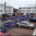
Digging pits, Rich Close, 20 May
A pit is dug to expose the old gas main for each property. This allows access for people and one vehicle, more convenient than if a continuous trench were dug.
Image: © Robin Stott
Taken: 20 May 2014
0.03 miles
6
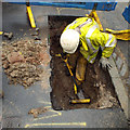
Easing the new gas main through the old, Rich Close, 4 June
The new main is sliding through the old.
Image: © Robin Stott
Taken: 4 Jun 2014
0.03 miles
7

Triangulating the squares, Rich Close, 5 June
Guessing, a triangle of barriers signals that the domestic connection has been made.
Image: © Robin Stott
Taken: 5 Jun 2014
0.03 miles
8

May in Aprll, Warwick
Maynard Avenue ends at a railway embankment. Hawthorn has spread up and along it and in this view is in full flower at the end of April, well in advance of its traditional blossoming in May. Whether this is due to the warming climate, who knows? This abundance promises a spectacular autumn harvest of crimson berries (already evident at the time of submission, late May).
Photo number 8108898.
Image: © Robin Stott
Taken: 30 Apr 2025
0.03 miles
9
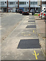
All reinstated, Rich Close, 6 June
Back to normal! The spraypaint marks seem to be gradually washed or worn off.
Image: © Robin Stott
Taken: 6 Jun 2014
0.03 miles
10

Temporary connections are a work in progress, 27 May
Some coils of new domestic connection pipe are waiting to be fitted.
Image: © Robin Stott
Taken: 27 May 2014
0.03 miles