1
Warwick houses [58]
Mill Street is a delightful and picturesque cul-de-sac. Number 12 Mill Street has an 18th century front in brick on possibly an earlier building. Listed, grade II, with details at: https://historicengland.org.uk/listing/the-list/list-entry/1184818
A market town and county town of Warwickshire, Warwick lies on the River Avon, 11 miles (18 kilometres) south of Coventry. There is evidence of unbroken habitation from the 6th century AD with signs of Neolithic and Roman activity before that date. It was a Saxon burh in the 9th century and Warwick Castle was built during the Norman Conquest. Much of the town was destroyed in The Great Fire of Warwick in 1694. Warwick Racecourse is located just west of the town centre. The Grand Union Canal passes through the town and the restored Saltisford Canal Arm is close to the town centre.
Image: © Michael Dibb
Taken: 5 Aug 2020
0.01 miles
2
Mill Lane, Warwick
Image: © SMJ
Taken: 16 Oct 2011
0.01 miles
3
Warwick houses [61]
Mill Street is a delightful and picturesque cul-de-sac. Millers Place, number 15 Mill Street is 18th century in red brick. Listed, grade II, with details at: https://historicengland.org.uk/listing/the-list/list-entry/1035423
A market town and county town of Warwickshire, Warwick lies on the River Avon, 11 miles (18 kilometres) south of Coventry. There is evidence of unbroken habitation from the 6th century AD with signs of Neolithic and Roman activity before that date. It was a Saxon burh in the 9th century and Warwick Castle was built during the Norman Conquest. Much of the town was destroyed in The Great Fire of Warwick in 1694. Warwick Racecourse is located just west of the town centre. The Grand Union Canal passes through the town and the restored Saltisford Canal Arm is close to the town centre.
Image: © Michael Dibb
Taken: 5 Aug 2020
0.01 miles
4
Mill Street, Warwick
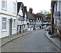
Old street full of Tudor housing near Warwick Castle.
Image: © James Denham
Taken: 21 Aug 2010
0.01 miles
5
Warwick houses [56]
Mill Street is a delightful and picturesque cul-de-sac. Originally one house, now three, numbers 6, 8 and 10 Mill Street. Probably early 17th century, timber framed. Number 6 and part or number 8 have had the front rebuilt in brick. The rest of number 8 and all of number 10 are in heavy square timber framing with number 10 jettied at fisrt floor level. Listed, grade II, with details at: https://historicengland.org.uk/listing/the-list/list-entry/1035430
A market town and county town of Warwickshire, Warwick lies on the River Avon, 11 miles (18 kilometres) south of Coventry. There is evidence of unbroken habitation from the 6th century AD with signs of Neolithic and Roman activity before that date. It was a Saxon burh in the 9th century and Warwick Castle was built during the Norman Conquest. Much of the town was destroyed in The Great Fire of Warwick in 1694. Warwick Racecourse is located just west of the town centre. The Grand Union Canal passes through the town and the restored Saltisford Canal Arm is close to the town centre.
Image: © Michael Dibb
Taken: 5 Aug 2020
0.01 miles
6
Fine Architecture, Warwick
Interesting doorway with arch and shell decoration in the core of the old town.
Image: © Colin Smith
Taken: 15 Aug 2009
0.01 miles
7
Mill Street near Warwick Castle
Image: © Mat Fascione
Taken: 18 Apr 2015
0.01 miles
8
Warwick houses [62]
Mill Street is a delightful and picturesque cul-de-sac. Number 18 Mill Street is 18th century in red brick with stone dressings and a nice shell hood. Listed, grade II, with details at: https://historicengland.org.uk/listing/the-list/list-entry/1035387
A market town and county town of Warwickshire, Warwick lies on the River Avon, 11 miles (18 kilometres) south of Coventry. There is evidence of unbroken habitation from the 6th century AD with signs of Neolithic and Roman activity before that date. It was a Saxon burh in the 9th century and Warwick Castle was built during the Norman Conquest. Much of the town was destroyed in The Great Fire of Warwick in 1694. Warwick Racecourse is located just west of the town centre. The Grand Union Canal passes through the town and the restored Saltisford Canal Arm is close to the town centre.
Image: © Michael Dibb
Taken: 5 Aug 2020
0.01 miles
9
Warwick houses [60]
Mill Street is a delightful and picturesque cul-de-sac. The Malt House is located between numbers 13 and 15 and is 17th century in sandstone ashlar and has been well restored. Listed, grade II, with details at: https://historicengland.org.uk/listing/the-list/list-entry/1184748
A market town and county town of Warwickshire, Warwick lies on the River Avon, 11 miles (18 kilometres) south of Coventry. There is evidence of unbroken habitation from the 6th century AD with signs of Neolithic and Roman activity before that date. It was a Saxon burh in the 9th century and Warwick Castle was built during the Norman Conquest. Much of the town was destroyed in The Great Fire of Warwick in 1694. Warwick Racecourse is located just west of the town centre. The Grand Union Canal passes through the town and the restored Saltisford Canal Arm is close to the town centre.
Image: © Michael Dibb
Taken: 5 Aug 2020
0.01 miles
10
Warwick - From The Castle Ramparts
Image: © Peter Whatley
Taken: 28 May 2009
0.01 miles


![Warwick houses [58]](https://s3.geograph.org.uk/geophotos/06/61/07/6610787_25ff8fe3_120x120.jpg)

![Warwick houses [61]](https://s0.geograph.org.uk/geophotos/06/61/08/6610864_3d2b320b_120x120.jpg)

![Warwick houses [56]](https://s3.geograph.org.uk/geophotos/06/61/07/6610779_b7f2ad2a_120x120.jpg)


![Warwick houses [62]](https://s3.geograph.org.uk/geophotos/06/61/08/6610875_f285b306_120x120.jpg)
![Warwick houses [60]](https://s3.geograph.org.uk/geophotos/06/61/08/6610847_aa679b8a_120x120.jpg)
