IMAGES TAKEN NEAR TO
Puckerings Lane, WARWICK, CV34 4EA

Introduction

This page details the photographs taken nearby to Puckerings Lane, CV34 4EA by members of the Geograph project.

The Geograph project started in 2005 with the aim of publishing, organising and preserving representative images for every square kilometre of Great Britain, Ireland and the Isle of Man.

There are currently over 7.5m images from over14,400 individuals and you can help contribute to the project by visiting https://www.geograph.org.uk

Image Map


Images are licensed for reuse under creativecommons.org/licenses/by-sa/2.0
Notes
  • Clicking on the map will re-center to the selected point.
  • The higher the marker number, the further away the image location is from the centre of the postcode.

Image Listing (1198 Images Found)

Images are licensed for reuse under creativecommons.org/licenses/by-sa/2.0
  • ...
Image
Details
Distance
1
Inspection cover by Westgate House, Puckerings Lane, Warwick
The maker's name, in relief, is Dudley & Dowell Ltd Warley Worc's. The location is seen in Image
Image: © Robin Stott Taken: 13 May 2015
0.01 miles
2
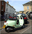
Street banter, The Square, Warwick
Nice bike, sir!
Image: © Kenneth Allen Taken: 14 Apr 2007
0.01 miles
3
The "Tuckery", Market Place, Warwick
Advertising the local shop nearby. The front tyre is deflated but the bike isn't going anywhere.
Image: © Kenneth Allen Taken: 14 Apr 2007
0.01 miles
4
Market Square, Warwick
How green is this?
Image: © Kenneth Allen Taken: 14 Apr 2007
0.01 miles
5
Road resurfacing operations, Brook Street
The county council undertook some just-in-time works in Warwick ahead of the relay, which visited Warwick, Leamington and Kenilworth on Sunday 1st July 2012 before heading off to Coventry. The difficult junction at the south end of Brook Street, behind the camera has been closed and paved Image, creating a quiet space for the contractor's plant and materials. Here a bag of the top dressing is being transferred Image
Image: © Robin Stott Taken: 27 Jun 2012
0.02 miles
6
Warwick - Lord Leycester Hospital - Egyptian urn & Norman arch
An ancient Grade I listed Egyptian Urn, originally part of a Nilometer (a structure for measuring the Nile River's clarity and water level during the annual flood season) framed by a Grade II* listed Norman arch dating from the C12th which was reconstructed from stones found under the floor of the Hospital's chapel.
Image: © Rob Farrow Taken: 24 Oct 2021
0.02 miles
7
Warwick bus station
The bus station continues to be a success. If only more people travelled by bus. On the right is the lower end of Market Street. In the centre is the flats development on the site of the showroom and the former printing works Image A similar view to the present photo is Image from 2015.
Image: © Robin Stott Taken: 11 Jul 2019
0.02 miles
8
Warwick's new bus depot
The town's refurbished bus depot taken from the garden of Lord Leycester Hospital.
Image: © Colin Craig Taken: 7 Apr 2009
0.02 miles
9
Warwick features [8]
In the rear garden of The Lord Leycester Hospital is this 18th century gazebo. Listed, grade II, with details at: https://historicengland.org.uk/listing/the-list/list-entry/1035442 A market town and county town of Warwickshire, Warwick lies on the River Avon, 11 miles (18 kilometres) south of Coventry. There is evidence of unbroken habitation from the 6th century AD with signs of Neolithic and Roman activity before that date. It was a Saxon burh in the 9th century and Warwick Castle was built during the Norman Conquest. Much of the town was destroyed in The Great Fire of Warwick in 1694. Warwick Racecourse is located just west of the town centre. The Grand Union Canal passes through the town and the restored Saltisford Canal Arm is close to the town centre.
Image: © Michael Dibb Taken: 7 Aug 2020
0.02 miles
10
Bus station, Warwick
Image: © Dylan Moore Taken: 29 Jun 2016
0.02 miles
  • ...