IMAGES TAKEN NEAR TO
Swan Street, WARWICK, CV34 4BJ
Introduction
This page details the photographs taken nearby to Swan Street, CV34 4BJ by members of the Geograph project.
The Geograph project started in 2005 with the aim of publishing, organising and preserving representative images for every square kilometre of Great Britain, Ireland and the Isle of Man.

There are currently over 7.5m images from over14,400 individuals and you can help contribute to the project by visiting https://www.geograph.org.uk
Image Map
Images are licensed for reuse under creativecommons.org/licenses/by-sa/2.0
Notes
- Clicking on the map will re-center to the selected point.
- The higher the marker number, the further away the image location is from the centre of the postcode.
Image Listing (1482 Images Found)
Images are licensed for reuse under creativecommons.org/licenses/by-sa/2.0
Image
Details
Distance
1
![Warwick buildings [107]](https://s3.geograph.org.uk/geophotos/06/62/16/6621671_cd9f4055_120x120.jpg)
Warwick buildings [107]
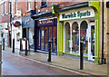
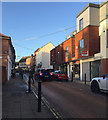
Number 16 (nearest the camera 'Cabin News') and number 14 ('Present Days') Swan Street. are both early 19th century in red brick. The shop fronts are both mid/late 19th century. Both are listed, grade II, with the details for number 16 at: https://historicengland.org.uk/listing/the-list/list-entry/1035364, and the details for number 14 at: https://historicengland.org.uk/listing/the-list/list-entry/1250169
A market town and county town of Warwickshire, Warwick lies on the River Avon, 11 miles (18 kilometres) south of Coventry. There is evidence of unbroken habitation from the 6th century AD with signs of Neolithic and Roman activity before that date. It was a Saxon burh in the 9th century and Warwick Castle was built during the Norman Conquest. Much of the town was destroyed in The Great Fire of Warwick in 1694. Warwick Racecourse is located just west of the town centre. The Grand Union Canal passes through the town and the restored Saltisford Canal Arm is close to the town centre.
Image: © Michael Dibb
Taken: 7 Aug 2020
0.01 miles
2
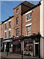
Shops on Swan Street, Warwick
Shops come and go, but some, like Cabin News and Present Days, endure for decades. Present Days was there in 1985, when the building was listed Grade II and described in the listing as early 19th century, with a late 19th century shop front. Greggs is a more recent arrival. See the Historic England site https://historicengland.org.uk/listing/the-list/list-entry/1250169 .
Image: © A J Paxton
Taken: 26 Aug 2023
0.01 miles
3
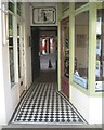
Tiled passage to a rear car park, Swan Street, Warwick
Image: © Robin Stott
Taken: 13 May 2015
0.01 miles
5
![Warwick buildings [106]](https://s0.geograph.org.uk/geophotos/06/62/16/6621652_d59b40f1_120x120.jpg)
Warwick buildings [106]
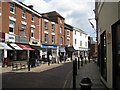
Now housing a bank, this building was The Red Lion public house. The building is early 17th century, timber framed with a 19th century stucco facade. The Red Lion, earlier named The White Hart and before that The Dolphin closed in the 1980s. The building was converted in the late 20th century. Listed, grade II, with details at: https://historicengland.org.uk/listing/the-list/list-entry/1035363
A market town and county town of Warwickshire, Warwick lies on the River Avon, 11 miles (18 kilometres) south of Coventry. There is evidence of unbroken habitation from the 6th century AD with signs of Neolithic and Roman activity before that date. It was a Saxon burh in the 9th century and Warwick Castle was built during the Norman Conquest. Much of the town was destroyed in The Great Fire of Warwick in 1694. Warwick Racecourse is located just west of the town centre. The Grand Union Canal passes through the town and the restored Saltisford Canal Arm is close to the town centre.
Image: © Michael Dibb
Taken: 7 Aug 2020
0.01 miles
6
![Warwick buildings [108]](https://s3.geograph.org.uk/geophotos/06/62/16/6621679_1f81021a_120x120.jpg)
Warwick buildings [108]
Number 20 Swan Street is early/mid 19th century in red brick. The shop front is mid 20th century. Listed, grade II, with details at: https://historicengland.org.uk/listing/the-list/list-entry/1364870
A market town and county town of Warwickshire, Warwick lies on the River Avon, 11 miles (18 kilometres) south of Coventry. There is evidence of unbroken habitation from the 6th century AD with signs of Neolithic and Roman activity before that date. It was a Saxon burh in the 9th century and Warwick Castle was built during the Norman Conquest. Much of the town was destroyed in The Great Fire of Warwick in 1694. Warwick Racecourse is located just west of the town centre. The Grand Union Canal passes through the town and the restored Saltisford Canal Arm is close to the town centre.
Image: © Michael Dibb
Taken: 7 Aug 2020
0.01 miles
7

Warwick
The Shropshire Bedlams, seen during the Warwick Folk Festival, in Swan Street.
Image: © Peter Trimming
Taken: 23 Jul 2016
0.01 miles
9
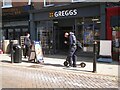
Gripped outside Greggs, Warwick
Electric scooters are the latest hazard to be avoided on our pavements, along with A-boards and people engrossed in content on their phones. Here outside Greggs at 20 Swan Street scrolling is more urgent than rolling. There have been reports in the media of explosions or fires occurring while scooters' lithium batteries were being recharged. Greggs is a popular chain of bakers.
Photo number 7596951.
Image: © Robin Stott
Taken: 18 Apr 2023
0.01 miles