IMAGES TAKEN NEAR TO
Church Lees, LEAMINGTON SPA, CV33 9RQ
Introduction
This page details the photographs taken nearby to Church Lees, CV33 9RQ by members of the Geograph project.
The Geograph project started in 2005 with the aim of publishing, organising and preserving representative images for every square kilometre of Great Britain, Ireland and the Isle of Man.

There are currently over 7.5m images from over14,400 individuals and you can help contribute to the project by visiting https://www.geograph.org.uk
Image Map
Images are licensed for reuse under creativecommons.org/licenses/by-sa/2.0
Notes
- Clicking on the map will re-center to the selected point.
- The higher the marker number, the further away the image location is from the centre of the postcode.
Image Listing (36 Images Found)
Images are licensed for reuse under creativecommons.org/licenses/by-sa/2.0
Image
Details
Distance
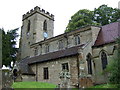
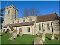
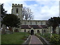
3
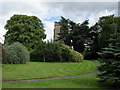
Village greenery and the church
At Bishop's Tachbrook.
Image: © James Denham
Taken: 21 Aug 2010
0.04 miles
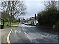

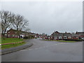
7
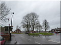
Junction of Mallory Road and Church Lees
Image: © Basher Eyre
Taken: 8 Feb 2019
0.05 miles