
IMAGES TAKEN NEAR TO
The Pound, LEAMINGTON SPA, CV33 9HH
Introduction
This page details the photographs taken nearby to The Pound, CV33 9HH by members of the Geograph project.
The Geograph project started in 2005 with the aim of publishing, organising and preserving representative images for every square kilometre of Great Britain, Ireland and the Isle of Man.

There are currently over 7.5m images from over14,400 individuals and you can help contribute to the project by visiting https://www.geograph.org.uk
Image Map
Images are licensed for reuse under creativecommons.org/licenses/by-sa/2.0
Notes
- Clicking on the map will re-center to the selected point.
- The higher the marker number, the further away the image location is from the centre of the postcode.
Image Listing (47 Images Found)
Images are licensed for reuse under creativecommons.org/licenses/by-sa/2.0
Image
Details
Distance
1
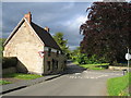
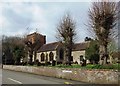
Harbury
Looking towards The Pound, Harbury with some splendid trees and a cottage that shows signs of a new and higher roof being added.
Image: © David Stowell
Taken: 24 May 2005
0.07 miles
2
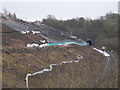
Landslip in Harbury Cutting
Remedial work underway to stabilise a landslip on the ex-GWR Leamington Spa to Banbury line. Slips in this cutting have been common since the opening of the line in 1852.
Image: © Barry Bolland
Taken: 5 Feb 2015
0.07 miles
3
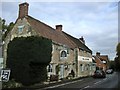
Harbury-The Crown Inn
Public House on Crown Street.
Image: © Ian Rob
Taken: 23 Oct 2010
0.09 miles
4
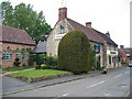
Harbury
The Crown, near to the Church.
Image: © David Stowell
Taken: 24 May 2005
0.09 miles
5
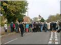
Remembrance Day Parade, Harbury
Villagers taking silence
Image: © Alan Spencer
Taken: 12 Nov 2006
0.10 miles
7
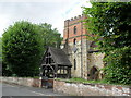
All Saints Church at Harbury
Entrance to churchyard and the Tower beyond.
Image: © James Denham
Taken: 21 Aug 2010
0.12 miles
10
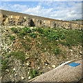
Remediation at the site of the Harbury landslips, 2014-15
The soiled bank above the rock layer is the edge of the extensive platform that is the floor of Network Rail's excavation. The thinking may have been that if another landslip took place it would not reach the railway. The B4452 road runs just beyond the skyline. The blue cover signifies surface water drainage: a series of them extends along by the track. Photographed from the 16:10 Chiltern Railways service from London Marylebone to Birmingham, about seven minutes from Leamington Spa, Sunday 15 May 2016. See Image], taken the day after the 2015 event.
Image: © Robin Stott
Taken: 15 May 2016
0.12 miles