
IMAGES TAKEN NEAR TO
Mulberry Close, LEAMINGTON SPA, CV32 7UU
Introduction
This page details the photographs taken nearby to Mulberry Close, CV32 7UU by members of the Geograph project.
The Geograph project started in 2005 with the aim of publishing, organising and preserving representative images for every square kilometre of Great Britain, Ireland and the Isle of Man.

There are currently over 7.5m images from over14,400 individuals and you can help contribute to the project by visiting https://www.geograph.org.uk
Image Map
Images are licensed for reuse under creativecommons.org/licenses/by-sa/2.0
Notes
- Clicking on the map will re-center to the selected point.
- The higher the marker number, the further away the image location is from the centre of the postcode.
Image Listing (33 Images Found)
Images are licensed for reuse under creativecommons.org/licenses/by-sa/2.0
Image
Details
Distance
1
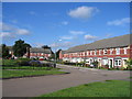
Chestnut Square, Royal Leamington Spa
This development occupies land that for many years was used for allotments. The house design attempts to match many of the older terraces in the town. Unfortunately however the architect failed to replicate the vertical proportions of the buildings with the result that these properties look like they have been partially squashed by a giant foot!
Image: © David Stowell
Taken: 28 Aug 2005
0.08 miles
2
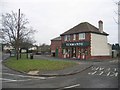
Valley Road off licence
This solitary shop is by the small green near the northern edge of this square. It serves the adjacent 1930s and 1950s housing estates in this part of the town.
Image: © David Stowell
Taken: 2 Jan 2006
0.10 miles
3
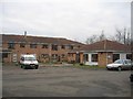
Charles Watson Court
The other one of the two adjacent retirement home and sheltered accommodation complex in this area in the north of this square. This one, the more recent of the two, is on Shuckburgh Drive
Image: © David Stowell
Taken: 2 Jan 2006
0.12 miles
5
Whitacre Road
A residential area mainly housing pensioners
Image: © Richard Lawson
Taken: 17 Jul 2002
0.14 miles
6
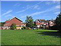
Pleasant Way
Part of the 1970s development around the site of the former claypits and works of the Leamington Brick Company in the middle of this square.
Image: © David Stowell
Taken: 28 Aug 2005
0.15 miles
7
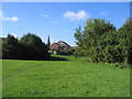
Site of Leamington Brick Company
The claypits and works of the Leamington Brick Company occupied the SW corner of this square and provided the material for much of the construction of Leamington Spa until the middle of the last century. The pits have long since been filled in and grassed over to form an open space. This picture is looking SW with the spire of St Paul's visible on Leicester St. The area around the edge of the pits was developed for housing in the 1960s and 70s.
Image: © David Stowell
Taken: 28 Aug 2005
0.15 miles
8
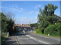
Leicester Street from the Campion Hills
There are not many hills of note in Leamington Spa, and this view is looking down the lower part of the steepest as the road descends from the Campion Hills. The traffic calming measures in the shadows were introduced to restrict the activities of boy-racers who used to speed down here.
Image: © David Stowell
Taken: 28 Aug 2005
0.16 miles
9
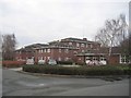
Acorn Court
This building on Whitacre road is one of two modern retirement homes near the northern edge of this square. It is surrounded by sheltered accommodation for the more independent elderly people. The day care centre on the right also doubles as a polling station for elections.
Image: © David Stowell
Taken: 2 Jan 2006
0.16 miles
10
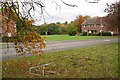
Greenspace on the bend of Haddon Road
A footpath goes down to Valley Road. The foreground suggests a range of scenarios, none of them happy.
Image: © Robin Stott
Taken: 22 Oct 2009
0.16 miles