
IMAGES TAKEN NEAR TO
Dunblane Drive, LEAMINGTON SPA, CV32 7TL
Introduction
This page details the photographs taken nearby to Dunblane Drive, CV32 7TL by members of the Geograph project.
The Geograph project started in 2005 with the aim of publishing, organising and preserving representative images for every square kilometre of Great Britain, Ireland and the Isle of Man.

There are currently over 7.5m images from over14,400 individuals and you can help contribute to the project by visiting https://www.geograph.org.uk
Image Map
Images are licensed for reuse under creativecommons.org/licenses/by-sa/2.0
Notes
- Clicking on the map will re-center to the selected point.
- The higher the marker number, the further away the image location is from the centre of the postcode.
Image Listing (46 Images Found)
Images are licensed for reuse under creativecommons.org/licenses/by-sa/2.0
Image
Details
Distance
1
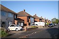
Dunblane Drive, New Cubbington
The estate was planned in 1927 but scarcely developed until after the second world war. All the roads are named after Scottish places and people "because of the ancestry of the landowners".
Image: © Robin Stott
Taken: 24 Oct 2009
0.08 miles
2
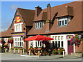
The Rugby Tavern, Cubbington
Colourful family pub on Rugby Road; a landmark on the road into Leamington Spa.
Image: © Stephen McKay
Taken: 11 Sep 2007
0.09 miles
3
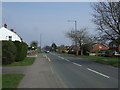
Rugby Road (B4453), Cubbington
Heading north east.
Image: © JThomas
Taken: 28 Mar 2014
0.10 miles
5
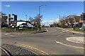
Northwest on Kenilworth Road from the crossroads, Cubbington
A reverse view is Image
Image: © Robin Stott
Taken: 26 Feb 2021
0.10 miles
6
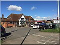
Rugby Tavern and Sainsbury's Local, Cubbington Road, Cubbington
Image: © Robin Stott
Taken: 26 Feb 2021
0.11 miles
7
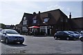
Cubbington-The Rugby Tavern
Large Public House on Rugby Road.
Image: © Ian Rob
Taken: 9 Apr 2011
0.11 miles
8
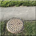
Inspectiom cover, Cubbington Road
It is embossed 'Warwick Corporation', suggesting that it dates from before local government reorganisation of the 1970s, perhaps earlier.
Image: © Robin Stott
Taken: 16 Sep 2021
0.11 miles
10
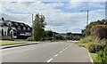
Northwest on Kenilworth Road, Cubbington, with two wagons
It's possible that the wagons are carrying spoil from HS2 excavations north of Cubbington village. They'll be heading for the A445 Leicester Lane north.
Image: © Robin Stott
Taken: 16 Sep 2021
0.11 miles