
IMAGES TAKEN NEAR TO
Beaufort Avenue, LEAMINGTON SPA, CV32 7TA
Introduction
This page details the photographs taken nearby to Beaufort Avenue, CV32 7TA by members of the Geograph project.
The Geograph project started in 2005 with the aim of publishing, organising and preserving representative images for every square kilometre of Great Britain, Ireland and the Isle of Man.

There are currently over 7.5m images from over14,400 individuals and you can help contribute to the project by visiting https://www.geograph.org.uk
Image Map
Images are licensed for reuse under creativecommons.org/licenses/by-sa/2.0
Notes
- Clicking on the map will re-center to the selected point.
- The higher the marker number, the further away the image location is from the centre of the postcode.
Image Listing (39 Images Found)
Images are licensed for reuse under creativecommons.org/licenses/by-sa/2.0
Image
Details
Distance
1
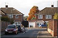
Houses, Beaufort Avenue, New Cubbington
Seen from the south-west end of Dunblane Drive. The estate was planned in 1927 but scarcely developed until after the second world war. All the roads are named after Scottish places and people "because of the ancestry of the landowners".
Image: © Robin Stott
Taken: 24 Oct 2009
0.02 miles
2
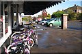
Kelvin Road shops
The cycle shop is popular and has a huge stock. The postbox ID is CV32 234.
Image: © Robin Stott
Taken: 24 Oct 2009
0.08 miles
3
Telford Junior School, Telford Avenue, Lillington
Image: © Robin Stott
Taken: 16 Sep 2021
0.12 miles
4
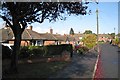
Roxburgh Croft, New Cubbington
Looking away from the greenspace towards Stirling Avenue. The estate was planned in 1927 but scarcely developed until after the second world war. All the roads are named after Scottish places and people "because of the ancestry of the landowners".
Image: © Robin Stott
Taken: 24 Oct 2009
0.13 miles
5
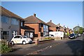
Dunblane Drive, New Cubbington
The estate was planned in 1927 but scarcely developed until after the second world war. All the roads are named after Scottish places and people "because of the ancestry of the landowners".
Image: © Robin Stott
Taken: 24 Oct 2009
0.15 miles
6
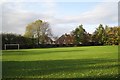
Kinross Road beyond Cubbington Waterworks greenspace
Image: © Robin Stott
Taken: 24 Oct 2009
0.15 miles
7
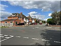
Kinross Road, Lillington
Many roads in the area take the names of Scottish towns or families.
Image: © Robin Stott
Taken: 16 Sep 2021
0.15 miles
9
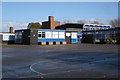
Telford Primary School, Leamington Spa
Seen from a footpath between Telford Avenue and Kelvin Road. On a Saturday.
Image: © Robin Stott
Taken: 24 Oct 2009
0.16 miles
10
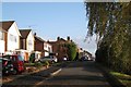
South View Road, Cubbington
The Cubbington Waterworks greenspace is through a gap in the railings to the right, on the parish boundary, so it's technically in Royal Leamington Spa.
Image: © Robin Stott
Taken: 24 Oct 2009
0.16 miles