
IMAGES TAKEN NEAR TO
Leicester Lane, LEAMINGTON SPA, CV32 7HE
Introduction
This page details the photographs taken nearby to Leicester Lane, CV32 7HE by members of the Geograph project.
The Geograph project started in 2005 with the aim of publishing, organising and preserving representative images for every square kilometre of Great Britain, Ireland and the Isle of Man.

There are currently over 7.5m images from over14,400 individuals and you can help contribute to the project by visiting https://www.geograph.org.uk
Image Map
Images are licensed for reuse under creativecommons.org/licenses/by-sa/2.0
Notes
- Clicking on the map will re-center to the selected point.
- The higher the marker number, the further away the image location is from the centre of the postcode.
Image Listing (16 Images Found)
Images are licensed for reuse under creativecommons.org/licenses/by-sa/2.0
Image
Details
Distance
1
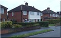
Houses on Montrose Avenue, Lillington
A residential street in a northern suburb of Leamington Spa. No 55, in the picture, was the home of my mum's father for many years.
Image: © Andrew Hill
Taken: 4 Oct 2013
0.08 miles
3
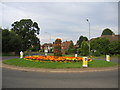
Leicester Lane roundabout in bloom in July
This is the roundabout at the junction of Leicester Lane (straight ahead), Sandy Lane (to the left) and Lime Avenue (to the right). The decoration is part of Leamington Spa's entry for the Town in Bloom competition. The photo is taken standing on the boundary of the square looking North.
Image: © David Stowell
Taken: 30 Jul 2005
0.12 miles
4
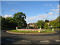
Leicester Lane roundabout in bloom in May
This is the roundabout at the junction of Leicester Lane (straight ahead), Sandy Lane (to the left) and Lime Avenue (to the right). Notice the changing floral display in the later Image
Image: © David Stowell
Taken: 22 May 2005
0.12 miles
5
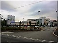
The new North Leamington School, Sandy Lane, Leamington
The new school opened in September 2009. Details of the construction team can be seen on the sign on the left - a close up of which can be found at Image] For a view of the opposite side of the buildings see Image]
In November 2010 the school won the Civic Building of the Year 2010 award from the Society of Chief Architects of Local Authorities (SCALA). It had already achieved a BREEAM Excellent award, a Considerate Constructors silver award and a Design Award from the Forum for Constructing Excellence.
Image: © John Brightley
Taken: 12 Jul 2010
0.14 miles
6

Sign at the new North Leamington School
Details of the construction team - a close up of the sign seen in Image]
Image: © John Brightley
Taken: 12 Jul 2010
0.14 miles
7

Entrance to Brethren's Meeting Room site, Sandy Lane
Image: © John Brightley
Taken: 12 Jul 2010
0.15 miles
8
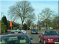
Waiting at the road works
View along Leicester Lane towards the roundabout junction with Sandy Lane and Lime Avenue. Major sewer replacement work has been ongoing for several months now in Leicester Lane and Lime Avenue, causing huge disruption to traffic. I keep forgetting to take another route, and sometimes end up stuck around here for ages.
Image: © David P Howard
Taken: 24 Mar 2011
0.15 miles
9
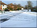
Montrose Avenue, Lillington
View NE up Montrose Avenue from the junction with St. Andrews Road on a snowy December morning.
Image: © Fred Howard
Taken: 27 Dec 2005
0.19 miles
10
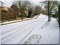
St Andrews Road, Lillington
View SE up St. Andrews Road on a snowy December morning.
Image: © Fred Howard
Taken: 27 Dec 2005
0.20 miles