
IMAGES TAKEN NEAR TO
Montrose Avenue, LEAMINGTON SPA, CV32 7DY
Introduction
This page details the photographs taken nearby to Montrose Avenue, CV32 7DY by members of the Geograph project.
The Geograph project started in 2005 with the aim of publishing, organising and preserving representative images for every square kilometre of Great Britain, Ireland and the Isle of Man.

There are currently over 7.5m images from over14,400 individuals and you can help contribute to the project by visiting https://www.geograph.org.uk
Image Map
Images are licensed for reuse under creativecommons.org/licenses/by-sa/2.0
Notes
- Clicking on the map will re-center to the selected point.
- The higher the marker number, the further away the image location is from the centre of the postcode.
Image Listing (20 Images Found)
Images are licensed for reuse under creativecommons.org/licenses/by-sa/2.0
Image
Details
Distance
1
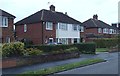
Houses on Montrose Avenue, Lillington
A residential street in a northern suburb of Leamington Spa. No 55, in the picture, was the home of my mum's father for many years.
Image: © Andrew Hill
Taken: 4 Oct 2013
0.02 miles
2
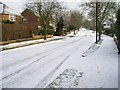
St Andrews Road, Lillington
View SE up St. Andrews Road on a snowy December morning.
Image: © Fred Howard
Taken: 27 Dec 2005
0.11 miles
3
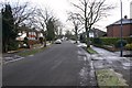
St Andrews Road, Lillington
View SE up St. Andrews Road on a frosty morning.
Image: © David P Howard
Taken: 2 Jan 2010
0.11 miles
4
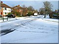
Montrose Avenue, Lillington
View NE up Montrose Avenue from the junction with St. Andrews Road on a snowy December morning.
Image: © Fred Howard
Taken: 27 Dec 2005
0.12 miles
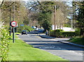
6
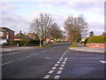
Telford Avenue
View WNW along Telford Avenue from the junction with Stirling Avenue.
Image: © Fred Howard
Taken: 18 Dec 2005
0.19 miles
7
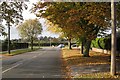
Junction of Telford Avenue and Leicester Lane, New Cubbington
Trees on the skyline are in the grounds of properties on the Stoneleigh Road at Blackdown. Image
Image: © Robin Stott
Taken: 24 Oct 2009
0.20 miles
8
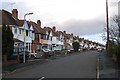
Kinross Road, New Cubbington
The middle length of Kinross Road seen from near the junction with Highland Road. The extension of the estate was planned in 1927 but scarcely developed until after the second world war. All the roads are named after Scottish places and people "because of the ancestry of the landowners".
Image: © Robin Stott
Taken: 24 Oct 2009
0.20 miles
9
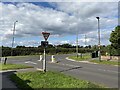
Telford Avenue meets Leicester Lane, Lillington
Some maps say Lillington Road.
Image: © Robin Stott
Taken: 16 Sep 2021
0.21 miles
10
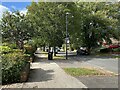
Downhill, northwest and a bus stop on Telford Avenue, Lillington
Stagecoach services 67A and 67B.
Image: © Robin Stott
Taken: 16 Sep 2021
0.21 miles