
IMAGES TAKEN NEAR TO
Blackdown, LEAMINGTON SPA, CV32 6RW
Introduction
This page details the photographs taken nearby to CV32 6RW by members of the Geograph project.
The Geograph project started in 2005 with the aim of publishing, organising and preserving representative images for every square kilometre of Great Britain, Ireland and the Isle of Man.

There are currently over 7.5m images from over14,400 individuals and you can help contribute to the project by visiting https://www.geograph.org.uk
Image Map
Images are licensed for reuse under creativecommons.org/licenses/by-sa/2.0
Notes
- Clicking on the map will re-center to the selected point.
- The higher the marker number, the further away the image location is from the centre of the postcode.
Image Listing (30 Images Found)
Images are licensed for reuse under creativecommons.org/licenses/by-sa/2.0
Image
Details
Distance
1
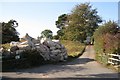
Quarry Park, Blackdown
Entrance seen from Old Milverton Lane/Road. The nature of the business here aroused my curiosity. Judging by the debris on the ground, the sacks might contain polystyrene packaging, produced in the newish shed up the slope (where a chap appeared to be changing his clothes). An aerial photo shows hundreds of such sacks laid on the ground in orderly fashion. A local streetmap, fairly up-to-date, shows the site as Quarry Market Garden.
Image: © Robin Stott
Taken: 16 Oct 2009
0.03 miles
2
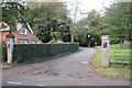
Entrance to Blackdown Clinic
The house is one of several Edwardian or late Victorian mansions in well-timbered grounds at Blackdown, north of Leamington Spa. Not visible from Old Milverton Lane/Road but in 2005 it looked like this Image The clinic is run by the British Pregnancy Advisory Service.
Image: © Robin Stott
Taken: 16 Oct 2009
0.05 miles
3
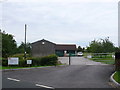
Quarry Buildings
This old workshop on the north side of Old Milverton Lane has recently become the home of MGR (fluid power) Hydraulic Engineers.
Image: © Nigel Mykura
Taken: 3 Jul 2011
0.08 miles
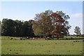
5
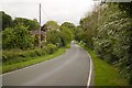
Old Milverton Lane
Viewed from the entrance to Sandy Lane Farm
Image: © Mark Anderson
Taken: 18 May 2019
0.08 miles
6
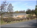
Disused barn, Sandy Lane, Leamington Spa
Looking north towards the barn. There was a Planning Site Notice attached to the gate which read: Reference No. W10/0156. Barn adjacent to Quarry Cottage. Change of use to offices (B1a), general industrial use (B2) and storage (B8).
Image: © David P Howard
Taken: 16 Mar 2010
0.08 miles
7
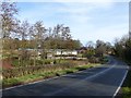
Old Milverton Road, Blackdown
The road to Old Milverton, rather than the 'old' road.
Image: © Alan Murray-Rust
Taken: 4 Mar 2017
0.09 miles
9
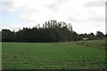
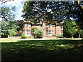
Small woodland behind Kenilworth Road properties, Blackdown
Five or so properties fronting Kenilworth Road Image have extensive grounds, beyond which is this small woodland, seen here from Old Milverton Lane or Road. A stream runs across the land pictured, towards the River Avon.
Image: © Robin Stott
Taken: 16 Oct 2009
0.11 miles
10
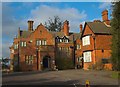
Blackdown the Hill
A photo of Blackdown clinic, Leamington Spa just off Old Milverton Lane. Currently the disc golfers of Quarry Park need to share the drive of the clinic to get to the course. Blackdown clinic is a Pregnancy Advisory clinic.
Image: © Richard Harrison
Taken: 29 Jan 2006
0.11 miles