1
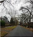
Garway Close, Lillington
An example of unfussy, respectable 20th century private housing introduced into the backland of, typically, the grounds of Victorian mansions, paddocks and nurseries.
Image: © Robin Stott
Taken: 23 Oct 2009
0.05 miles
2
Transforming The Cedars
This mansion in Lillington, Royal Leamington Spa is under conversion and extension into upmarket flats. According to the developers on site, the building was formerly offices, with dropped ceilings and other 60s conversion work hiding or damaging cornices and other period features. These have been reinstated in the original building with a period flavour maintained in the new build units. With the first show flat due for completion in May 2009 it will be interesting to see how sympathetic the final product is.
Image: © Colin Craig
Taken: 24 Mar 2009
0.07 miles
3
Park Road, Lillington, Leamington Spa
The 19th century road of vast mansions continues north with smaller-scale 20th century houses. A route to school: at the end of the road is the former North Leamington School upper school, now closed, whence a new cycle path leads to the replacement school complex.
Image Image
Image: © Robin Stott
Taken: 23 Oct 2009
0.08 miles
4
Belmont Road and Park House, Lillington, Leamington Spa
Belmont Road links the 19th century Park Road to respectable 20th century suburbia in the backland. Park House, although extended, gives a flavour of the massive late 19th/early 20th century mansions in this part of Lillington - favoured for its elevation, away from polluted watercourses. The future of Park House is uncertain.
Image: © Robin Stott
Taken: 23 Oct 2009
0.08 miles
5
Elm Bank Close
A quiet residential street tucked away behind the fast wide busy Lillington Road, A445.
Image: © Robin Stott
Taken: 23 Oct 2009
0.14 miles
6
Park Road gates to former North Leamington School
The school occupied two large adjacent sites on the northern edge of Leamington, both now closed. This was the upper school
Image The dark green gates on the right mark the start of the new cycle path to the replacement school, which opened in September 2009
Image
Image: © Robin Stott
Taken: 23 Oct 2009
0.17 miles
7
North Leamington Upper School and playing fields
East of the Kenilworth Road north of Leamington something in the order of 25 hectares is devoted to playing fields for a number of schools.
Image: © Robin Stott
Taken: 16 Oct 2009
0.17 miles
8
Cloister Crofts
Image: © Steve Fareham
Taken: 22 Nov 2016
0.17 miles
9
North Leamington Lower School and playing fields
East of the Kenilworth Road north of Leamington something in the order of 25 hectares is devoted to playing fields for a number of schools.
Image: © Robin Stott
Taken: 16 Oct 2009
0.19 miles
10
Cycle path and landscaping en route to North Leamington School
The new school, in
Image, is a replacement on one site for the upper and lower schools which occupied two large sites and are now closed. The new North Leamington School opened in September 2009. The path runs from the end of Park Road, thus maintaining a traditional, relatively safe route. Another view is John Brightley's
Image
Image: © Robin Stott
Taken: 23 Oct 2009
0.19 miles


