
IMAGES TAKEN NEAR TO
Edmondscote Road, LEAMINGTON SPA, CV32 6AG
Introduction
This page details the photographs taken nearby to Edmondscote Road, CV32 6AG by members of the Geograph project.
The Geograph project started in 2005 with the aim of publishing, organising and preserving representative images for every square kilometre of Great Britain, Ireland and the Isle of Man.

There are currently over 7.5m images from over14,400 individuals and you can help contribute to the project by visiting https://www.geograph.org.uk
Image Map
Images are licensed for reuse under creativecommons.org/licenses/by-sa/2.0
Notes
- Clicking on the map will re-center to the selected point.
- The higher the marker number, the further away the image location is from the centre of the postcode.
Image Listing (295 Images Found)
Images are licensed for reuse under creativecommons.org/licenses/by-sa/2.0
Image
Details
Distance
1
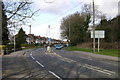
Prince's Drive, Leamington Spa
Railway embankment, right. The viewpoint is roughly at the extreme right of Image
Image: © Robin Stott
Taken: 22 Mar 2009
0.03 miles
2
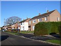
Edmonscote Road
This residential road mid way between Leamington and Warwick just north of the River Avon and just west of the Leamington to Kenilworth railway line is most significant because it is the access road to the Edmonscote Athletics track owned by Warwick District Council and used for schools and other local athletics meetings.
Image: © Nigel Mykura
Taken: 2 Jan 2012
0.04 miles
3

Warwickshire College, main building and College of Arts
Image: © Robin Stott
Taken: 29 Jan 2010
0.06 miles
4
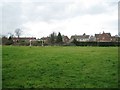
Goalposts, Edmondscote Field, and houses in Edmondscote Road
The field is open space that has escaped development by being partly in the floodplain of the Leam, being ground that was made up in the mid-nineteenth century, and having a role as overflow parking for events at the adjoining Edmondscote Athletics Track.
Image: © Robin Stott
Taken: 23 Dec 2012
0.08 miles
5
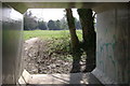
Flood relief culvert, Prince's Bridge
One of a pair that pass under Prince's Drive, bypassing Edmondscote weir.
They are well-used as subways into Edmondscote Field, particularly by students of nearby Warwickshire College.
Like the underside of the bridge, they attract high-quality graffiti by art and design students.
Image: © Robin Stott
Taken: 3 Apr 2009
0.08 miles
6

Edmondscote Field
A public open space of over two hectares, mostly in the floodplain of the River Leam, which runs behind the hedgerow, left.
It serves the Edmondscote estate, right, and as overflow parking for athletics and bowls events.
The Lombardy poplars follow the bend of the river Image; Image
The pylon is the one at Jephson's Farm that gets into so many views, eg: Image
Image: © Robin Stott
Taken: 3 Apr 2009
0.08 miles
7

Northbound freight, Leamington
The train is moving from right to left. It is but one of the several container freight trains (from Southampton, it is assumed) that pass through Leamington every day. Some go up the Chiltern Line to Birmingham's Freightliner Terminal perhaps but this train is heading for Coventry, perhaps on to Nuneaton and who knows where after that.
Photo number 8042492.
Image: © Robin Stott
Taken: 11 Nov 2024
0.08 miles
8
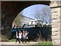
Milverton Riverside
Seen walking under the railway viaduct Image students of Warwickshire College take a lunchtime break.
Image: © Robin Stott
Taken: 3 Apr 2009
0.09 miles
9
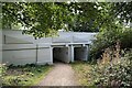
Flood relief conduits, Prince's Bridge, Leamington
Prince's Bridge takes Prince's Drive over the River Leam at Edmondscote; designed in Art Deco style it opened in 1923. The tops of the conduits can seen on the left in Image
Image reference: 7559412
Image: © Robin Stott
Taken: 23 Aug 2022
0.09 miles
10

Bench mark, Princes Drive bridge
See http://www.geograph.org.uk/photo/5304904 for location.
Image: © Alan Murray-Rust
Taken: 4 Mar 2017
0.09 miles