
IMAGES TAKEN NEAR TO
Sherbourne Terrace, Clarendon Street, LEAMINGTON SPA, CV32 5SP
Introduction
This page details the photographs taken nearby to Sherbourne Terrace, Clarendon Street, CV32 5SP by members of the Geograph project.
The Geograph project started in 2005 with the aim of publishing, organising and preserving representative images for every square kilometre of Great Britain, Ireland and the Isle of Man.

There are currently over 7.5m images from over14,400 individuals and you can help contribute to the project by visiting https://www.geograph.org.uk
Image Map
Images are licensed for reuse under creativecommons.org/licenses/by-sa/2.0
Notes
- Clicking on the map will re-center to the selected point.
- The higher the marker number, the further away the image location is from the centre of the postcode.
Image Listing (213 Images Found)
Images are licensed for reuse under creativecommons.org/licenses/by-sa/2.0
Image
Details
Distance
1
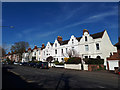
Houses on Lillington Road
The four houses nearest the camera have what are almost Dutch gables.
Image: © Stephen Craven
Taken: 20 Mar 2019
0.01 miles
2
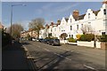
Houses on Clarendon Street
Viewed from the junction with Beauchamp Avenue.
Image: © Mark Anderson
Taken: 20 Mar 2019
0.01 miles
3
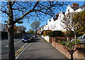
Clarendon Street in Royal Leamington Spa
Image: © Mat Fascione
Taken: 18 Apr 2015
0.02 miles
4
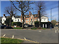
Terraced houses, Beauchamp Avenue, Royal Leamington Spa
The house in the centre appears to be of the same form as those on the left, but they have had a different surface treatment. Conservation Area guidelines recommend that houses be painted Magnolia or White, not always appropriately. It creates an appealing conformity but I don't know how authentic it is. Photos of post-war Leamington show terraces of grey cement render stained with soot from coal fires.
Image: © Robin Stott
Taken: 13 Apr 2021
0.03 miles
5
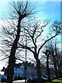
Trees on Beauchamp Avenue
Some have been more severely pruned than others.
Image: © Stephen Craven
Taken: 20 Mar 2019
0.04 miles
6
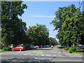
Binswood Avenue, Royal Leamington Spa
Looking westwards from the junction with Lillington Road.
Image: © David Stowell
Taken: 9 Jul 2005
0.05 miles
7
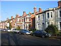
Lillington Road - Clarendon Street
These two roads meet end on at this point. As a result the house numbers descend (from left to right) 8, 6, 4, 2 on the brick faced buildings and then start again 1, 3 etc. on the painted houses. Good training for a novice postman!
Image: © David Stowell
Taken: 10 Dec 2005
0.05 miles
8
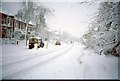
Snow on Lillington Road
After the heavy, and very sticky snowfall in December 1990 some traffic starts moving again.
Image: © David Stowell
Taken: Unknown
0.05 miles
9
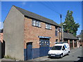
Workshop, Hill Street
Another one of the outbuildings at the rear of the large houses in Clarendon Street. Although probably originally built as a stables or coach house the premises are now the home of one of the local electrical contractors.
Image: © David Stowell
Taken: 28 Aug 2005
0.05 miles
10
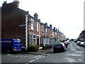
Villiers Street
One of many Victorian terraced streets on the northern side of the town centre. The road on the left is Waller Street though the sign high up on the wall can be read as Upper Hill Street. Hill Street is not visible off on the right.
Image: © Nigel Mykura
Taken: 28 Aug 2011
0.06 miles