
IMAGES TAKEN NEAR TO
Alveston Place, LEAMINGTON SPA, CV32 4SN
Introduction
This page details the photographs taken nearby to Alveston Place, CV32 4SN by members of the Geograph project.
The Geograph project started in 2005 with the aim of publishing, organising and preserving representative images for every square kilometre of Great Britain, Ireland and the Isle of Man.

There are currently over 7.5m images from over14,400 individuals and you can help contribute to the project by visiting https://www.geograph.org.uk
Image Map
Images are licensed for reuse under creativecommons.org/licenses/by-sa/2.0
Notes
- Clicking on the map will re-center to the selected point.
- The higher the marker number, the further away the image location is from the centre of the postcode.
Image Listing (551 Images Found)
Images are licensed for reuse under creativecommons.org/licenses/by-sa/2.0
Image
Details
Distance
1
'It's this way'
This tile warehouse in central Leamington Spa is making sure customers can find it.
Image: © Colin Craig
Taken: 3 Sep 2009
0.01 miles
2
Alveston Place, off Oxford Street, Leamington
The area for doors, dress fabrics, haberdashery and sewing machines.
Image: © Robin Stott
Taken: 7 Nov 2017
0.01 miles
3
East on Oxford Row, Leamington
H.B.Dunn, Chemist, in Oxford Street was one of the few places offering 'flu vaccinations locally in autumn 2022: an excellent service. We had expected 'flu shots at Southam with our Covid booster but on the day no 'flu vaccine was available. We had only gone to Southam because it had been impossible to book online for a couple travelling together to Stoneleigh. If we had only known I believe we could have just walked in for both Covid and 'flu at Stoneleigh. Doh! The early Covid vaccinations were superbly organised by local GPs; then the NHS and the government muscled in and made it all terribly complicated. On this occasion on the other hand GPs suffered no interruption to their work.
Image: © Robin Stott
Taken: 25 Oct 2022
0.02 miles
4
Clarendon Fruit Store, Clarendon Street
At some time a shop front has been inserted into a double-fronted house.
Image: © Christine Johnstone
Taken: 18 May 2019
0.02 miles
5
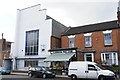
Abandoned hall
This building in central Leamington Spa looks like a former church or church hall with a new frontage added at some point when it was converted to what seems to have been an entertainment venue with offices at the rear. It has been abandoned for several years and currently has a for sale sign on it. Update (thanks to Geograph member Robin Stott) - this was a baptist chapel opened in 1863 which shut in 1921 before becoming the Gor-Ray clothing factory. This closed in 1972 and it has had a variety of uses since.
Image: © Colin Craig
Taken: 3 Sep 2009
0.02 miles
6
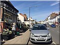
Clarendon Fruit Store and Clarendon Street, Royal Leamington Spa
Image: © Robin Stott
Taken: 13 Apr 2021
0.03 miles
7
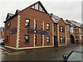
Medical Centre, Oxford Street, Leamington
Image: © Robin Stott
Taken: 7 Nov 2017
0.03 miles
8
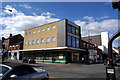
Given up the struggle
This used to be Bentleys, a long-established furnishing store in Leamington Spa that has recently closed due to the economic downturn and illness, according to a note in the window. The building itself may be extremely unsympathetic to the site (it's surrounded by Victorian and earlier property) but you have to mourn the passing of yet another local business.
Image: © Colin Craig
Taken: 4 Apr 2009
0.03 miles
9
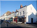
Clarendon Street shops
Another of the small clusters of shops that still exist just away from the main town centre. The Post Office here has been enlarged and is busier than ever following the closure of many others in the town including a main one at the top of the Parade.
Image: © David Stowell
Taken: 10 Dec 2005
0.04 miles
10
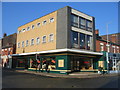
Corner of Warwick Street and Clarendon Street
This 1960s building was originally built to house the Army and Navy Shop if my memory serves me correctly. For many years it has housed a furniture business with frequent sales!
Image: © David Stowell
Taken: 28 Jan 2006
0.04 miles