IMAGES TAKEN NEAR TO
The Moorings, LEAMINGTON SPA, CV31 3QD
Introduction
This page details the photographs taken nearby to The Moorings, CV31 3QD by members of the Geograph project.
The Geograph project started in 2005 with the aim of publishing, organising and preserving representative images for every square kilometre of Great Britain, Ireland and the Isle of Man.

There are currently over 7.5m images from over14,400 individuals and you can help contribute to the project by visiting https://www.geograph.org.uk
Image Map
Images are licensed for reuse under creativecommons.org/licenses/by-sa/2.0
Notes
- Clicking on the map will re-center to the selected point.
- The higher the marker number, the further away the image location is from the centre of the postcode.
Image Listing (381 Images Found)
Images are licensed for reuse under creativecommons.org/licenses/by-sa/2.0
Image
Details
Distance
1
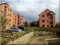
The Moorings flats, Myton Road
A canal warehouse-flavoured development that was stimulated by the building of the A452 Europa Way link to M40 junctions 13 and 14 in the 1980s. At lower right is the corner of a winding hole (space for a narrowboat to do a 3-point turn) on the Grand Union Canal.
Image: © Robin Stott
Taken: 13 Oct 2012
0.02 miles
2
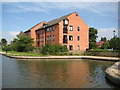
Grand Union Canal: Myton Winding Hole
A winding hole is a short section of widened canal that enables long narrowboats to make a 180 degree turn. This is a new one that seems to have been constructed as part of The Moorings residential development.
Image: © Nigel Cox
Taken: 5 Sep 2012
0.02 miles
3
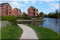
Winding hole along the Grand Union Canal
A turning point for narrow boats.
Image: © Mat Fascione
Taken: 18 Apr 2015
0.02 miles
4

Basin on the Grand Union Canal
Canals seem to attract new apartment blocks.
Image: © Bill Boaden
Taken: 19 Apr 2019
0.02 miles
5
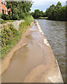
Puddles on the Grand Union towpath
This well-used urban towpath was upgraded some years ago. Unfortunately the attractive Bredon gravel (or similar) surface was rolled flat, so it has developed wear in the centre, showing after rain as a regularly spaced series of puddles (what's the maths behind that?). Self-setting gravel or fine hoggin should be rolled to a camber or to a cross-fall so that surface water is quickly shed.
Image: © Robin Stott
Taken: 22 Jun 2012
0.03 miles
6
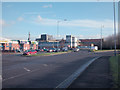
Myton Road
Out of town stores. The large industrial building in the centre background is part of the Ford Motor Company's Leamington foundry.
Image: © Dennis Turner
Taken: 16 Dec 2005
0.03 miles
7
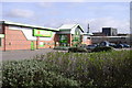
Car park and store, Myton Road, Leamington Spa
A well-established DIY store. The view is further back than Image
Image: © Robin Stott
Taken: 22 Mar 2009
0.03 miles
8
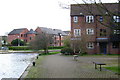
The Moorings, Myton Road, Warwick, seen from Howard Walk
Image: © Robin Stott
Taken: 7 Apr 2009
0.03 miles
9
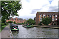
Two canalside developments, Myton, Warwick
On the left are The Moorings flats. On the right is Howard Walk off Aragon Drive. Converted canal warehouses are one thing but housing pretending to be warehousing is just sad. But official planning advice encourages this kind of retro/being in harmony. A Lidl store (out of shot, left) recently replaced a garden centre.
Image: © Robin Stott
Taken: 24 Jul 2009
0.03 miles