
IMAGES TAKEN NEAR TO
Avenue Road, LEAMINGTON SPA, CV31 3PF
Introduction
This page details the photographs taken nearby to Avenue Road, CV31 3PF by members of the Geograph project.
The Geograph project started in 2005 with the aim of publishing, organising and preserving representative images for every square kilometre of Great Britain, Ireland and the Isle of Man.

There are currently over 7.5m images from over14,400 individuals and you can help contribute to the project by visiting https://www.geograph.org.uk
Image Map
Images are licensed for reuse under creativecommons.org/licenses/by-sa/2.0
Notes
- Clicking on the map will re-center to the selected point.
- The higher the marker number, the further away the image location is from the centre of the postcode.
Image Listing (778 Images Found)
Images are licensed for reuse under creativecommons.org/licenses/by-sa/2.0
Image
Details
Distance
1
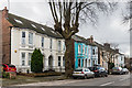
Avenue Road
A row of Victorian villas on the south side of Avenue Road.
Image: © Ian Capper
Taken: 4 Mar 2017
0.02 miles
2
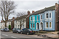
Avenue Road
A row of Victorian villas on the south side of Avenue Road.
Image: © Ian Capper
Taken: 4 Mar 2017
0.02 miles
3
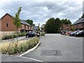
Close off Renshaw Drive, Royal Leamington Spa
Image: © Robin Stott
Taken: 19 Sep 2021
0.03 miles
4
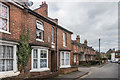
Victoria Street
A road of mainly 19th Century terraced housing.
Image: © Ian Capper
Taken: 4 Mar 2017
0.04 miles
5
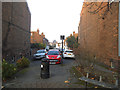
South end of Victoria Street, Leamington Spa
It looks to have been a through road originally, but now a dead end.
Image: © Stephen Craven
Taken: 17 Nov 2018
0.04 miles
6
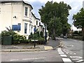
Junction of Station Approach and Avenue Road, Royal Leamington Spa
'Adelaide Road' on the street nameplate identifies the shortest of spurs of Adelaide Road south of the junction. It continues left as Station Approach Image It would be speculating to suggest that Adelaide Road formalised a route that had developed south of the river in the 1830s as the New Town grew and that it led to the Old Warwick Road, especially after the opening of Adelaide Bridge across the Leam. It would have been severed by the LNWR railway around the same time, 1850. The western end of the access to the Avenue Road station, that became Station Approach, began here. But this is all speculation.
Image: © Robin Stott
Taken: 19 Sep 2021
0.04 miles
7
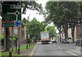
Leamington Spa A452 Turn Left Adelaide Road
Image: © Roy Hughes
Taken: 10 Aug 2013
0.04 miles
8
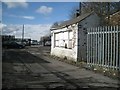
Former weighbridge and weigh office of coal depot, Royal Leamington Spa
The coal has long gone. The site is currently a second-hand car dealership. The weighbridge was made by Pooley of Birmingham http://www.geograph.org.uk/photo/3881374 http://www.gracesguide.co.uk/Henry_Pooley_and_Son The actual mechanism may have been removed and filled in. The view is from the western end of Station Approach, which once served the L&NWR's Avenue Road station.
Image: © Robin Stott
Taken: 11 Mar 2013
0.05 miles
9
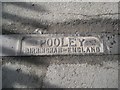
Logo of Pooley of Birmingham, weighbridge manufacturer
The context is seen here http://www.geograph.org.uk/photo/3881351 http://www.gracesguide.co.uk/Henry_Pooley_and_Son
Image: © Robin Stott
Taken: 11 Mar 2013
0.05 miles
10
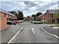
Close off Renshaw Drive, Royal Leamington Spa
Image: © Robin Stott
Taken: 19 Sep 2021
0.05 miles