
IMAGES TAKEN NEAR TO
Westlea Road, LEAMINGTON SPA, CV31 3JF
Introduction
This page details the photographs taken nearby to Westlea Road, CV31 3JF by members of the Geograph project.
The Geograph project started in 2005 with the aim of publishing, organising and preserving representative images for every square kilometre of Great Britain, Ireland and the Isle of Man.

There are currently over 7.5m images from over14,400 individuals and you can help contribute to the project by visiting https://www.geograph.org.uk
Image Map
Images are licensed for reuse under creativecommons.org/licenses/by-sa/2.0
Notes
- Clicking on the map will re-center to the selected point.
- The higher the marker number, the further away the image location is from the centre of the postcode.
Image Listing (276 Images Found)
Images are licensed for reuse under creativecommons.org/licenses/by-sa/2.0
Image
Details
Distance
1
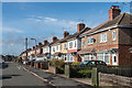
Westlea Road
1930s housing built in the grounds of the now demolished Shrubland Hall.
Image: © Ian Capper
Taken: 4 Mar 2017
0.01 miles
2
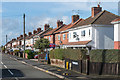
Westlea Road
1930s housing built in the grounds of the now demolished Shrubland Hall.
Image: © Ian Capper
Taken: 4 Mar 2017
0.02 miles
3
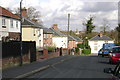
Lee Road
Looking down Lee Road to Bury Road.
On the skyline is the tower of St Mark's Church, Rugby Road, a kilometre away – socially and environmentally as well as physically.
Image: © Robin Stott
Taken: 7 Apr 2009
0.03 miles
4
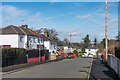
Lee Road
1930s housing built in the grounds of the now demolished Shrubland Hall.
Image: © Ian Capper
Taken: 4 Mar 2017
0.05 miles
5
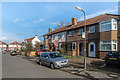
Southlea Avenue
1930s housing built in the grounds of the now demolished Shrubland Hall.
Image: © Ian Capper
Taken: 4 Mar 2017
0.05 miles
6
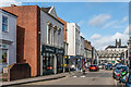
Clemens Street
Row of shops along Clemens Street. The bridge in the background carries the railway from Banbury into Leamington Spa station. The building on the left, now housing John Atkins Cycles, was originally a non-conformist chapel, built in 1816, before becoming a theatre by the mid 19th Century. It later reverted to being a church, being shown as a Free Congregational Church on the 1887 1:500 town plan (with "seats for 400"). In around 1910 the building was bought by the Zephyr Carburettor Company who used it to manufacture brakes for the first Wolsley cars. In 1929 the company was bought by Automotive Products, the start of that company's long association with Leamington Spa until its decline in the late 20th Century.
Image: © Ian Capper
Taken: 4 Mar 2017
0.05 miles
7
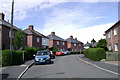
Summit of Kennan Avenue, Leamington
Near its junction with Swadling Street, indicated by the white house, right.
Image: © Robin Stott
Taken: 30 Jul 2009
0.07 miles
8
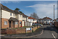
Southlea Close
1930s housing built in the grounds of the now demolished Shrubland Hall.
Image: © Ian Capper
Taken: 4 Mar 2017
0.07 miles
10
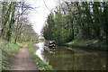
Grand Union Canal, Leamington Spa
A tree-lined cutting on the western side of Leamington gives canal users an impression of countryside.
But to the north (left) is the busy Old Warwick Road and to the south (right) is an extensive housing estate beyond the tree-belt.
Image: © Robin Stott
Taken: 5 Apr 2009
0.09 miles