IMAGES TAKEN NEAR TO
Flavel Crescent, LEAMINGTON SPA, CV31 3HX
Introduction
This page details the photographs taken nearby to Flavel Crescent, CV31 3HX by members of the Geograph project.
The Geograph project started in 2005 with the aim of publishing, organising and preserving representative images for every square kilometre of Great Britain, Ireland and the Isle of Man.

There are currently over 7.5m images from over14,400 individuals and you can help contribute to the project by visiting https://www.geograph.org.uk
Image Map
Images are licensed for reuse under creativecommons.org/licenses/by-sa/2.0
Notes
- Clicking on the map will re-center to the selected point.
- The higher the marker number, the further away the image location is from the centre of the postcode.
Image Listing (716 Images Found)
Images are licensed for reuse under creativecommons.org/licenses/by-sa/2.0
Image
Details
Distance
2
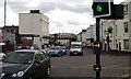
High Street, Leamington Spa
The name High Street dates from the time when the village of Leamington Priors was developing as a fashionable spa south of the river. When the New Town north of the river outpaced the Old Town, the name High Street became an anachronism. It is still one of Leamington's busiest roads.
Image: © Robin Stott
Taken: 5 Apr 2009
0.04 miles
3
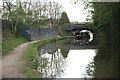
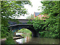
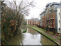
Grand Union Canal, Leamington Spa
A cruising canal boat passes under Tachbrook Road bridge.
Image: © Robin Stott
Taken: 5 Apr 2009
0.04 miles
4
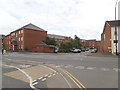
Gas Street, Leamington Spa
Guess what - it once led to a gas works (now housing called Frances Havergal Close).
Image: © Stephen Craven
Taken: 18 May 2019
0.05 miles
6
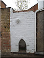
Curious feature on Priory Street
A whitewashed panel of a brick wall, with a boot scraper at the bottom and a moulded head looking down.
Image: © Stephen Craven
Taken: 18 May 2019
0.06 miles
7
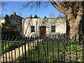
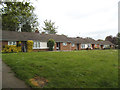
Former pumping station, Tachbrook Road, Royal Leamington Spa
This little building first appears on a map of 1938 at the same time as the Kingsway housing estate built by Leamington Corporation; a couple of houses in Bury Road can be seen. The ground rises to the left (south); maybe the station pumped the town's water to the new estate. Now it looks like a dwelling. The colour of the paint and the style of the plate by the door, 'G46', suggests a connection with Station House, recently-built student accommodation fronting Old Warwick Road across the canal; the flats are numbered 1-45.
Image: © Robin Stott
Taken: 13 Mar 2017
0.06 miles
8
Grand Union Canal, Bridge 41 looking east, Leamington
Image: © Andy F
Taken: 22 May 2009
0.06 miles
10
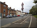
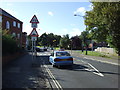
Tachbrook Road, Leamington Spa
Complete with segregated cycle lane.
Image: © Stephen Craven
Taken: 18 May 2019
0.07 miles