
IMAGES TAKEN NEAR TO
Central Avenue, LEAMINGTON SPA, CV31 3EZ
Introduction
This page details the photographs taken nearby to Central Avenue, CV31 3EZ by members of the Geograph project.
The Geograph project started in 2005 with the aim of publishing, organising and preserving representative images for every square kilometre of Great Britain, Ireland and the Isle of Man.

There are currently over 7.5m images from over14,400 individuals and you can help contribute to the project by visiting https://www.geograph.org.uk
Image Map
Images are licensed for reuse under creativecommons.org/licenses/by-sa/2.0
Notes
- Clicking on the map will re-center to the selected point.
- The higher the marker number, the further away the image location is from the centre of the postcode.
Image Listing (63 Images Found)
Images are licensed for reuse under creativecommons.org/licenses/by-sa/2.0
Image
Details
Distance
1
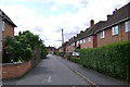
Hawthorn Road, Leamington Spa
Seen from its junction with Baker Avenue.
Image: © Robin Stott
Taken: 30 Jul 2009
0.03 miles
2
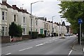
Tachbrook Road, Leamington Spa
Terraced houses with staggered fronts are characteristic of the north end of Tachbrook Road.
Image: © Robin Stott
Taken: 24 Aug 2009
0.09 miles
3
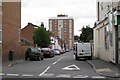
Top of St George's Road, Leamington Spa
Looking from its junction with Tachbrook Road towards Radcliffe Gardens flats in Brunswick Street.
Image: © Robin Stott
Taken: 24 Aug 2009
0.09 miles
4
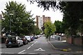
Top of Claremont Road, Leamington Spa
Looking from Its junction with Tachbrook Road towards Lisle Court flats, Brunswick Street, in SP3264.
Image: © Robin Stott
Taken: 24 Aug 2009
0.09 miles
5
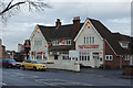
The Wheatsheaf, Leamington Spa
A Banks's pub on Tachbrook Road built in the inter-war period.
Image: © Stephen McKay
Taken: 22 Nov 2014
0.10 miles
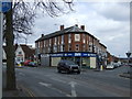
7
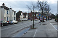
Tachbrook Road, Leamington Spa
Looking towards the Wheatsheaf pub.
Image: © Stephen McKay
Taken: 22 Nov 2014
0.10 miles
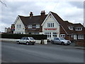
9
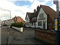
The Wheatsheaf
Tachbrook Road, Leamington Spa.
Image: © David Lally
Taken: 8 Apr 2009
0.10 miles
10
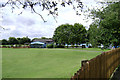
Kingsway Community Primary School, Leamington Spa
Seen here from the south end of The Approach. There is a nursery here also. The trees on the left are on the boundary with Queensway. A view from that direction is: Image
Image: © Robin Stott
Taken: 30 Jul 2009
0.10 miles