
IMAGES TAKEN NEAR TO
Tachbrook Road, LEAMINGTON SPA, CV31 3AL
Introduction
This page details the photographs taken nearby to Tachbrook Road, CV31 3AL by members of the Geograph project.
The Geograph project started in 2005 with the aim of publishing, organising and preserving representative images for every square kilometre of Great Britain, Ireland and the Isle of Man.

There are currently over 7.5m images from over14,400 individuals and you can help contribute to the project by visiting https://www.geograph.org.uk
Image Map
Images are licensed for reuse under creativecommons.org/licenses/by-sa/2.0
Notes
- Clicking on the map will re-center to the selected point.
- The higher the marker number, the further away the image location is from the centre of the postcode.
Image Listing (297 Images Found)
Images are licensed for reuse under creativecommons.org/licenses/by-sa/2.0
Image
Details
Distance
2
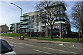
Sayer Court, Tachbrook Road, south Leamington
Sayer Court is a development by Warwick District Council of council-built flats for the over-55s, for rent not for sale; 81 flats in all and five bungalows for people of any age with a disability. The site was formerly an older council property, Fetherston Court, part-seen in Image The trees are Tree of Heaven (Ailanthus altissima). https://www.warwickdc.gov.uk/news/article/125/flagship_council_housing_development_opened
Image: © Robin Stott
Taken: 13 Mar 2017
0.00 miles
3
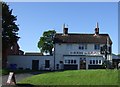
The Sun, Tachbrook Road, Royal Leamington Spa
Image: © JThomas
Taken: 29 Sep 2012
0.01 miles
4
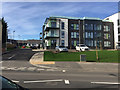
Sayer Court, south wing and bungalows at rear, Tachbrook Road, Leamington
These are new council flats for rent to the over-55s. The bungalows are purpose-built for people of any age with a disability. The site was formerly an older council housing development, Fetherston Court.
Image: © Robin Stott
Taken: 13 Mar 2017
0.02 miles
5
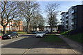
East end of Kingsway, south Leamington
Ahead, modest 19th-century houses on Tachbrook Road. To the left, Maxstoke Gardens, older low-rise council flats. To the right, Sayer Court, new council-built flats for the over-55s for rent not for sale; 81 flats in all and five bungalows for people of any age with a disability. The site was formerly an older council property, Fetherston Court, part-seen in Image The trees are mostly Tree of Heaven (Ailanthus altissima).
Image: © Robin Stott
Taken: 13 Mar 2017
0.02 miles
6
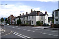
Lower end of Tachbrook Road, Leamington Spa
This 19th century terrace with a staggered frontage is characteristic of this part of the road. The land behind it was the long-derelict gasworks site, now redeveloped.
Image: © Robin Stott
Taken: 30 Jul 2009
0.03 miles
7
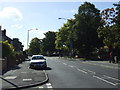
Tachbrook Road, Royal Leamington Spa
The B4087 heading south.
Image: © JThomas
Taken: 29 Sep 2012
0.03 miles
8

Benchmark on #77 Tachbrook Road
Ordnance Survey cut mark benchmark described on the Bench Mark Database at http://www.bench-marks.org.uk/bm44543
Image: © Roger Templeman
Taken: 11 Aug 2012
0.03 miles
9
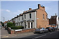
Junction of Tachbrook Road and Ranelagh Terrace
There is an OS benchmark Image on the Ranelagh Terrace face of the house at the corner (#77 Tachbrook Road)
Image: © Roger Templeman
Taken: 11 Aug 2012
0.03 miles
10
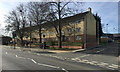
Tachbrook Court flats, Tachbrook Road, Royal Leamington Spa
Built by Leamington Corporation around 1960, at a guess, based on old maps. On the right can be seen some of the single-storey accommodation associated with Sayer Court Image
Image: © Robin Stott
Taken: 13 Mar 2017
0.04 miles