
IMAGES TAKEN NEAR TO
Forsythia Way, LEAMINGTON SPA, CV31 2SN
Introduction
This page details the photographs taken nearby to Forsythia Way, CV31 2SN by members of the Geograph project.
The Geograph project started in 2005 with the aim of publishing, organising and preserving representative images for every square kilometre of Great Britain, Ireland and the Isle of Man.

There are currently over 7.5m images from over14,400 individuals and you can help contribute to the project by visiting https://www.geograph.org.uk
Image Map
Images are licensed for reuse under creativecommons.org/licenses/by-sa/2.0
Notes
- Clicking on the map will re-center to the selected point.
- The higher the marker number, the further away the image location is from the centre of the postcode.
Image Listing (26 Images Found)
Images are licensed for reuse under creativecommons.org/licenses/by-sa/2.0
Image
Details
Distance
1
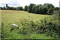
Field by Fieldgate Lane, Whitnash
Looking towards the rural section of Golf Lane
Image: © Robin Stott
Taken: 22 Aug 2009
0.03 miles
2
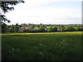
Meadow south of Fieldgate Lane
Looking across the southern end of Whitnash from Golf Lane.
Image: © Robin Stott
Taken: 30 May 2010
0.05 miles
3
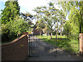
Gates to a drive off Golf Lane
A handful of properties are hidden away on the north side of the lane. Photography is hampered by trees and a gridline.
Image: © Robin Stott
Taken: 30 May 2010
0.10 miles
4
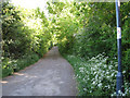
Golf Lane continues south?
…as a track and bridleway, here ascending Mollington Hill.
Image: © Robin Stott
Taken: 30 May 2010
0.10 miles
5
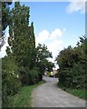
Golf Lane, Whitnash
Its southern end is a track, seen here approaching the junction with Fieldgate Lane.
Image: © Robin Stott
Taken: 22 Aug 2009
0.10 miles
6
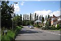
Fieldgate Lane, Whitnash
Looking towards Golf Lane and the boundary of the Leamington and County golf course.
Image: © Robin Stott
Taken: 22 Aug 2009
0.10 miles
7
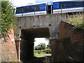
Railway bridge, Fieldgate Lane, Whitnash
A Leamington-bound Chiltern service crosses bridge DCL 124. Fieldgate Lane continues a short way to a single property.
Image: © Robin Stott
Taken: 22 Aug 2009
0.11 miles
8
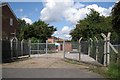
Sewage pumping station, Fieldgate Lane, Whitnash
Image: © Robin Stott
Taken: 22 Aug 2009
0.11 miles
9
Fieldgate Lane, Whitnash
View WSW up Fieldgate Lane from next to the railway bridge at the end of the lane.
Image: © David P Howard
Taken: 5 Dec 2010
0.11 miles
10
Mullard Drive, Whitnash
Seen from the junction with Fieldgate Lane, this is almost the southern extremity of Leamington's suburbs.
Image: © Stephen McKay
Taken: 24 Mar 2012
0.14 miles