
IMAGES TAKEN NEAR TO
Golf Lane, LEAMINGTON SPA, CV31 2PT
Introduction
This page details the photographs taken nearby to Golf Lane, CV31 2PT by members of the Geograph project.
The Geograph project started in 2005 with the aim of publishing, organising and preserving representative images for every square kilometre of Great Britain, Ireland and the Isle of Man.

There are currently over 7.5m images from over14,400 individuals and you can help contribute to the project by visiting https://www.geograph.org.uk
Image Map
Images are licensed for reuse under creativecommons.org/licenses/by-sa/2.0
Notes
- Clicking on the map will re-center to the selected point.
- The higher the marker number, the further away the image location is from the centre of the postcode.
Image Listing (18 Images Found)
Images are licensed for reuse under creativecommons.org/licenses/by-sa/2.0
Image
Details
Distance
1
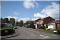
Kirton Close, Whitnash
Seen from Golf Lane, with school grounds beyond. Several residential roads in Whitnash have been named after local politicians, Bernard Kirton being one of the best-known. At one time he was concurrently a town councillor, a district councillor and a county councillor.
Image: © Robin Stott
Taken: 22 Aug 2009
0.05 miles
4
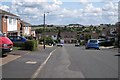
The crest of Morris Drive, Whitnash
Looking towards Golf Lane and the countryside south of Radford Semele.
Image: © Robin Stott
Taken: 22 Aug 2009
0.13 miles
5
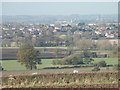
Whitnash from Crown Hill
Warwick Castle and St.Mary's Church, Warwick in background.
Image: © Barry Bolland
Taken: 21 Nov 2013
0.15 miles
6

Magnolia blossom
One of the delights of spring, to be found in many a suburban garden, seen against a perfect blue sky.
Image: © Stephen McKay
Taken: 24 Mar 2012
0.15 miles
7
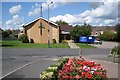
Whitnash Methodist Church, Murcott Road East
Image: © Robin Stott
Taken: 22 Aug 2009
0.18 miles
8
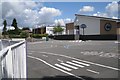
St Margaret's Church of England Junior School, Coppice Road, Whitnash
Much-extended.
Image: © Robin Stott
Taken: 22 Aug 2009
0.19 miles
9
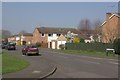
Mullard Drive, Whitnash
Seen from the junction with Fieldgate Lane, this is almost the southern extremity of Leamington's suburbs.
Image: © Stephen McKay
Taken: 24 Mar 2012
0.19 miles
10
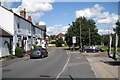
The north-east end of Murcott Road East, Whitnash
Approaching its junction with Heathcote Road.
Image: © Robin Stott
Taken: 22 Aug 2009
0.21 miles