
IMAGES TAKEN NEAR TO
The Doglands, LEAMINGTON SPA, CV31 2HE
Introduction
This page details the photographs taken nearby to The Doglands, CV31 2HE by members of the Geograph project.
The Geograph project started in 2005 with the aim of publishing, organising and preserving representative images for every square kilometre of Great Britain, Ireland and the Isle of Man.

There are currently over 7.5m images from over14,400 individuals and you can help contribute to the project by visiting https://www.geograph.org.uk
Image Map
Images are licensed for reuse under creativecommons.org/licenses/by-sa/2.0
Notes
- Clicking on the map will re-center to the selected point.
- The higher the marker number, the further away the image location is from the centre of the postcode.
Image Listing (71 Images Found)
Images are licensed for reuse under creativecommons.org/licenses/by-sa/2.0
Image
Details
Distance
1
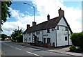
Whitnash-Cook's Cottages
Close to The Doglands.
Image: © Ian Rob
Taken: 20 Jun 2016
0.03 miles
2
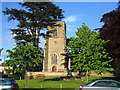
Whitnash
The church at the heart of this old town
Image: © David Stowell
Taken: 21 May 2005
0.05 miles
3
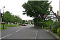
Church Lane, Whitnash, Leamington Spa
Approaching its junction with Whitnash Road. Church out of shot, left. Obelisk war memorial on the green, left. The original farmhouse to Green Farm, right, but the farm is now a housing estate.
Image: © Robin Stott
Taken: 3 Aug 2009
0.05 miles
4
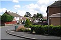
Palmer Road, Whitnash
Looking towards St Margaret's Parish Church by Whitnash Road.
Image: © Robin Stott
Taken: 22 Aug 2009
0.05 miles
5
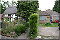
The Doglands, Whitnash, Leamington Spa
A characteristic juxtaposition. Whitnash is an ancient village that was joined to south Leamington in the twentieth century.
Image: © Robin Stott
Taken: 3 Aug 2009
0.05 miles
6

Looking along Church Lane towards Whitnash Road
Image: © Basher Eyre
Taken: 8 Feb 2019
0.06 miles
7
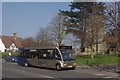
Goldline G1 at Whitnash
A bus on the branded G1 route between Warwick and Whitnash pulls away from Whitnash Church. Stagecoach claims this is the most frequent bus route in Warwickshire, running every 8 minutes through the day, although frequencies are dramatically curtailed in the evenings and on Sundays.
Image: © Stephen McKay
Taken: 24 Mar 2012
0.07 miles
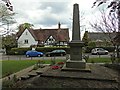
9
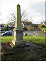
Whitnash War Memorial, the east face
The site is between the tower of St Margaret's Church (behind the camera) and Whitnash Road. It is 15 feet high, of Cornish granite. It was unveiled by Lord Leigh on Sunday 12th June 1921 in the presence of 1,000 people. Originally commemorating the ten Whitnash men who fell in the First World War it records the names of those who lost their lives in later conflicts, as here, as well as 50 years of peace in August 1995.
Image: © Robin Stott
Taken: 16 Dec 2012
0.07 miles
10
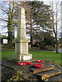
Whitnash War Memorial on the Green
The site is between the tower of St Margaret's Church and Whitnash Road. It is 15 feet high, of Cornish granite. It was unveiled by Lord Leigh on Sunday 12th June 1921 in the presence of 1,000 people. Originally commemorating the ten Whitnash men who fell in the First World War it records the names of those who lost their lives in later conflicts, as well as 50 years of peace in August 1995.
Image: © Robin Stott
Taken: 16 Dec 2012
0.07 miles