
IMAGES TAKEN NEAR TO
CV31 1PS
Introduction
This page details the photographs taken nearby to CV31 1PS by members of the Geograph project.
The Geograph project started in 2005 with the aim of publishing, organising and preserving representative images for every square kilometre of Great Britain, Ireland and the Isle of Man.

There are currently over 7.5m images from over14,400 individuals and you can help contribute to the project by visiting https://www.geograph.org.uk
Image Map
Images are licensed for reuse under creativecommons.org/licenses/by-sa/2.0
Notes
- Clicking on the map will re-center to the selected point.
- The higher the marker number, the further away the image location is from the centre of the postcode.
Image Listing (100 Images Found)
Images are licensed for reuse under creativecommons.org/licenses/by-sa/2.0
Image
Details
Distance
1
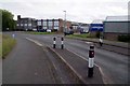
St Mary's Industrial Estate
An industrial estate beside the Grand Union Canal.
Image: © Glyn Baker
Taken: 16 Jul 2016
0.02 miles
2
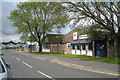
Small firms' works, St Mary's Road CV31
The place on the right does digital copying and printing. Print runs up to 200 copies are economical, I was told. When I collected a job, they were busy: all the machines running. Printing ink — ah Bisto! Print, in some form, will never die. St Mary's Road gives its name to this industrial estate in south Leamington.
Image: © Robin Stott
Taken: 14 May 2012
0.03 miles
3
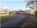
Traffic calming in St Mary's Road
As St. Mary's road goes over the canal and enters the Sydenham Industrial Estate, there is a chicane in the road.
Image: © David P Howard
Taken: 5 Dec 2010
0.04 miles
4
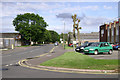
St Mary's Road, Sydenham Industrial Estate
The 20th century extension of a 19th century residential street. Extensive premises of H.J.Heinz, right.
Image: © Robin Stott
Taken: 5 Aug 2009
0.04 miles
5
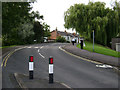
Traffic calming, St Mary's Road, Leamington Spa
Approaching Bridge 37 over the Grand Union Canal. A 19th century residential street, centre, has been pushed across the canal in the 20th century to serve an industrial estate.
Image: © Robin Stott
Taken: 5 Aug 2009
0.04 miles
6
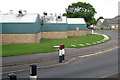
Elisabeth the Chef's factory, Sydenham Industrial Estate
They make cakes and gateaux, seen here from across St Mary's Road.
Image: © Robin Stott
Taken: 5 Aug 2009
0.04 miles
7
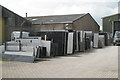
Stone merchant's stockyard, Ramsey Road CV31
Sheets of polished granite and marble in a rack, like so many slices of toast. Guessing, mostly used for flooring and worktops, not gravestones. The company is Bellagio Stone Ltd. There is another rack on premises across the road. Ramsey Road is on the St Mary's Road industrial estate.
Image: © Robin Stott
Taken: 14 May 2012
0.04 miles
8
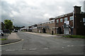
Caswell Road CV31
Part of the St Mary's Road industrial estate in south Leamington. Pole Star Foods, right, are believed to make frozen desserts.
Image: © Robin Stott
Taken: 14 May 2012
0.05 miles
9
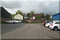
Works' car park and the end of Clapham Terrace CV31
A zigzagging wall with a strange pillar feature separates St Mary's Road industrial estate from residential Clapham Terrace.
Image: © Robin Stott
Taken: 14 May 2012
0.05 miles
10
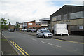
Snack van, Ramsey Road CV31
There is space for the van, called The Nosh Box, on a vacant parking area by an empty factory. There are several empty premises here on the St Mary's Road industrial estate but still enough occupied to support a snack van. The building left of centre (in the next square) is the HQ and furniture shop of the local Action 21 group.
Image: © Robin Stott
Taken: 14 May 2012
0.06 miles