
IMAGES TAKEN NEAR TO
Judge Close, RUGBY, CV23 9BY
Introduction
This page details the photographs taken nearby to Judge Close, CV23 9BY by members of the Geograph project.
The Geograph project started in 2005 with the aim of publishing, organising and preserving representative images for every square kilometre of Great Britain, Ireland and the Isle of Man.

There are currently over 7.5m images from over14,400 individuals and you can help contribute to the project by visiting https://www.geograph.org.uk
Image Map
Images are licensed for reuse under creativecommons.org/licenses/by-sa/2.0
Notes
- Clicking on the map will re-center to the selected point.
- The higher the marker number, the further away the image location is from the centre of the postcode.
Image Listing (40 Images Found)
Images are licensed for reuse under creativecommons.org/licenses/by-sa/2.0
Image
Details
Distance
1

Clayhill Lane, Long Lawford
Clayhill Lane leads down to a ford across a small tributary of the River Avon. As the sign makes clear, motor vehicles are not encouraged.
Image: © Stephen McKay
Taken: 18 Feb 2021
0.04 miles
2
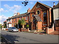
Long Lawford-Chapel Street
Cottages and a converted Chapel.
Image: © Ian Rob
Taken: 30 Oct 2007
0.06 miles
3
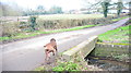
Ford at Long Lawford
This ford on Clayhill Lane is the smaller of the two fords at Long Lawford despite the best efforts of the dog in the foreground.
Image: © John Walton
Taken: 18 Feb 2017
0.08 miles
4
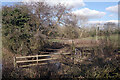
Stream at Long Lawford
Seen here from Clayhill Lane, this unnamed stream rises in the Cawston area and flows down to the River Avon. This is looking downstream.
Image: © Stephen McKay
Taken: 27 Feb 2021
0.08 miles
5

The former Country Inn, Long Lawford
This building ceased to be a pub about twenty years before this photograph was taken. It was a well-regarded establishment and its loss was keenly felt in the village but planning permission was granted for conversion of the 17th century building into a home partly because there were (and still are) two other pubs nearby. The associated land was sold off for housing but at least the 'Country Inn Mews' name is a reminder of what was once here.
Image: © Stephen McKay
Taken: 18 Feb 2021
0.09 miles
6
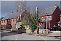
Cross Street, Long Lawford
As the name implies, Cross Street runs east-west across Long Lawford from School Street to Main Street and Chapel Street. This is the eastern end seen from School Street.
Image: © Stephen McKay
Taken: 18 Feb 2021
0.11 miles
7
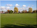
Long Lawford-Playing Field
King George V Playing Field and the Primary School beyond.
Image: © Ian Rob
Taken: 30 Oct 2007
0.12 miles
8

Long Lawford-Saint John's Church Hall
Services are held here as the adjacent church is now closed.
Image: © Ian Rob
Taken: 18 Sep 2014
0.12 miles
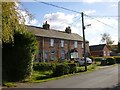
10
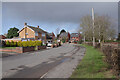
School Street, Long Lawford
The village school is no longer on School Street, but the road has retained its old name. To the right over the hedge is the King George V playing field.
Image: © Stephen McKay
Taken: 18 Feb 2021
0.12 miles