IMAGES TAKEN NEAR TO
Welton Road, RUGBY, CV23 8UR
Introduction
This page details the photographs taken nearby to Welton Road, CV23 8UR by members of the Geograph project.
The Geograph project started in 2005 with the aim of publishing, organising and preserving representative images for every square kilometre of Great Britain, Ireland and the Isle of Man.

There are currently over 7.5m images from over14,400 individuals and you can help contribute to the project by visiting https://www.geograph.org.uk
Image Map
Images are licensed for reuse under creativecommons.org/licenses/by-sa/2.0
Notes
- Clicking on the map will re-center to the selected point.
- The higher the marker number, the further away the image location is from the centre of the postcode.
Image Listing (6 Images Found)
Images are licensed for reuse under creativecommons.org/licenses/by-sa/2.0
Image
Details
Distance
1
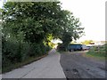
Barby-Chapel Farm
Road leading down to the farm.
Image: © Ian Rob
Taken: 12 Sep 2013
0.13 miles
2
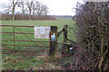
Stile on footpath northeast of the Welton to Barby road
Image: © Andy F
Taken: 31 Dec 2009
0.15 miles
3
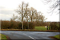
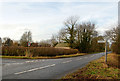
Junction of lane from Braunston with the Barby-Welton road
Image: © Andy F
Taken: 31 Dec 2009
0.16 miles
4
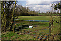
Farmland near Barby
Fields adjacent to the Barby - Welton road.
Image: © Stephen McKay
Taken: 31 Mar 2016
0.17 miles
5
Welton to Barby road at the junction of lane to Braunston
Image: © Andy F
Taken: 31 Dec 2009
0.18 miles
6
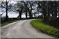
Lane to Braunston
This lane, signposted for light traffic only, leads off the Barby - Welton road and heads down Cleves Hill.
Image: © Stephen McKay
Taken: 31 Mar 2016
0.22 miles