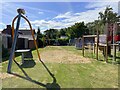
IMAGES TAKEN NEAR TO
The Horsepool, RUGBY, CV23 0SU
Introduction
This page details the photographs taken nearby to The Horsepool, CV23 0SU by members of the Geograph project.
The Geograph project started in 2005 with the aim of publishing, organising and preserving representative images for every square kilometre of Great Britain, Ireland and the Isle of Man.

There are currently over 7.5m images from over14,400 individuals and you can help contribute to the project by visiting https://www.geograph.org.uk
Image Map
Images are licensed for reuse under creativecommons.org/licenses/by-sa/2.0
Notes
- Clicking on the map will re-center to the selected point.
- The higher the marker number, the further away the image location is from the centre of the postcode.
Image Listing (38 Images Found)
Images are licensed for reuse under creativecommons.org/licenses/by-sa/2.0
Image
Details
Distance
1
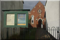
Lilbourne Evangelical Chapel
The chapel peeps round from behind another building, seen here from Chapel Lane.
Image: © Stephen McKay
Taken: 9 Oct 2011
0.05 miles
2
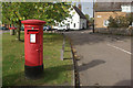
Lilbourne village green
Post box on the green in the centre of this small Northamptonshire village.
Image: © Stephen McKay
Taken: 9 Oct 2011
0.06 miles
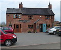
6
Village green, Lilbourne
Lilbourne is an attractive village centred on this green, but is lacking in facilities having neither a pub nor a shop.
Image: © Stephen McKay
Taken: 9 Oct 2011
0.07 miles
7
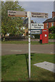
Signpost at Lilbourne
Signpost to nearby locations, including the green burial ground, in the centre of Lilbourne village.
Image: © Stephen McKay
Taken: 9 Oct 2011
0.07 miles
8
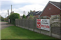
Protest at Lilbourne
'We say no to the Lilbourne Wind Farm'. The proposal in question is for the erection of six turbines (scaled back from an original proposal for 12) on the opposite side of the M1 from the village.
Image: © Stephen McKay
Taken: 9 Oct 2011
0.08 miles
9
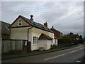
Lilbourne Old Schoolhouse
The converted School in Yelvertoft Road dates from 1873.
Image: © Ian Rob
Taken: 23 Jan 2008
0.08 miles