
IMAGES TAKEN NEAR TO
Harpers Yard, RUGBY, CV23 0JP
Introduction
This page details the photographs taken nearby to Harpers Yard, CV23 0JP by members of the Geograph project.
The Geograph project started in 2005 with the aim of publishing, organising and preserving representative images for every square kilometre of Great Britain, Ireland and the Isle of Man.

There are currently over 7.5m images from over14,400 individuals and you can help contribute to the project by visiting https://www.geograph.org.uk
Image Map
Images are licensed for reuse under creativecommons.org/licenses/by-sa/2.0
Notes
- Clicking on the map will re-center to the selected point.
- The higher the marker number, the further away the image location is from the centre of the postcode.
Image Listing (36 Images Found)
Images are licensed for reuse under creativecommons.org/licenses/by-sa/2.0
Image
Details
Distance
1
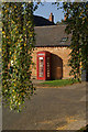
Telephone box in Harborough Magna
The K6 box is framed by the churchyard's trees; in common with most rural telephone boxes these days, it displays a prominent 'coins not accepted' notice.
Image: © Stephen McKay
Taken: 10 Oct 2010
0.02 miles
2
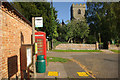
Harborough Magna
Looking along Main Street towards the 14th century All Saints' Church.
Image: © Stephen McKay
Taken: 10 Oct 2010
0.03 miles
3
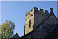
Harborough Magna Church
The tower of All Saints' Church dates from the 14th century.
Image: © Stephen McKay
Taken: 10 Oct 2010
0.03 miles
4
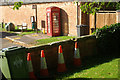
From the churchyard, Harborough Magna
Apart from the four traffic cones, there is quite a variety of bins in this view taken in the churchyard of All Saints' Church, including two wheelie bins, a litter bin and a salt bin.
Image: © Stephen McKay
Taken: 10 Oct 2010
0.03 miles
6
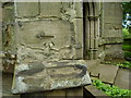
Benchmark on Harborough Magna Church
This benchmark was established in 1856 during the First primary levelling of England & Wales, and was levelled with a height of 391.6600 feet [119.3780 metres] above mean sea level (Liverpool datum). It was included on the Coventry to Lincoln levelling line (branch line from Stretton Toll House to Rugby). The surveyor's description was "Bolt in West face of tower of Harborough Magna Church ; 4.49 ft. above surface." The 1887 and 1905 maps show this mark on the north-west face of buttress, and the north-west corner of the tower. Although it doesn't appear on subsequent maps, probably because of the damage, it is easily found today.
Image: © Shantavira
Taken: 23 May 2015
0.03 miles
7
Church gate, Harborough Magna
For some reason a wheelie bin stands in the gateway to All Saints' Church. This was an exceptionally sunny and warm October afternoon.
Image: © Stephen McKay
Taken: 10 Oct 2010
0.03 miles
9
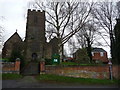
All Saints church, Harborough Magna
The clock face is interesting on this village church.
Image: © Jeremy Bolwell
Taken: 3 Dec 2009
0.04 miles
10
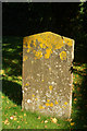
Harborough Magna Churchyard
Lichen on this gravestone in All Saints' churchyard has rendered it virtually unreadable, but it has caught the October sunlight.
Image: © Stephen McKay
Taken: 10 Oct 2010
0.05 miles