
IMAGES TAKEN NEAR TO
Watling Street, RUGBY, CV23 0AP
Introduction
This page details the photographs taken nearby to Watling Street, CV23 0AP by members of the Geograph project.
The Geograph project started in 2005 with the aim of publishing, organising and preserving representative images for every square kilometre of Great Britain, Ireland and the Isle of Man.

There are currently over 7.5m images from over14,400 individuals and you can help contribute to the project by visiting https://www.geograph.org.uk
Image Map
Images are licensed for reuse under creativecommons.org/licenses/by-sa/2.0
Notes
- Clicking on the map will re-center to the selected point.
- The higher the marker number, the further away the image location is from the centre of the postcode.
Image Listing (21 Images Found)
Images are licensed for reuse under creativecommons.org/licenses/by-sa/2.0
Image
Details
Distance
1
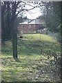
Picturesque bridleway near A5 Watling Street
Bridleway running south-west from M6 motorway (path X14) nears A5 Watling Street, alongside house.
Image: © Michael Westley
Taken: 16 Mar 2010
0.02 miles
2
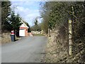
Bridleway, A5 Watling Street
On north side of A5 Watling Street, close to Watling Crescent begins a bridleway running north-east towards M6 motorway.
Image: © Michael Westley
Taken: 16 Mar 2010
0.03 miles
3
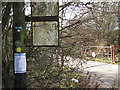
Builders Yard, A5 near Newton
Gateway and footpath sign on A5 Watling Street, near Europark - footpath runs down side of track into builders yard.
Notice on telegraph pole describes details of proposed changes to road access to Europark and A5 nearby.
Image: © Michael Westley
Taken: 26 Nov 2009
0.07 miles
4
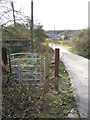
Builders yard, A5 near Newton
Kissing gate and Warwickshire County Council Right of Way signpost directing down the track into the builders yard
Image: © Michael Westley
Taken: 26 Nov 2009
0.08 miles
5
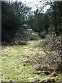
Bridleway nearing A5 Watling Street
A bridleway runs south along a narrow strip of land between fields.
The house ahead, borders both the bridleway and A5 Watling Street.
Image: © Michael Westley
Taken: 16 Mar 2010
0.09 miles
6
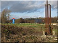
Old Petrol Station, near Europark, A5
View toward A5 from remains of petrol station once on dual carriageway, near Europark. The site is expected to be used in part for improved access into/out of Europark in future.
Image: © Michael Westley
Taken: 26 Nov 2009
0.11 miles
7
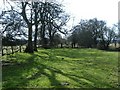
Corner of top field near A5
On bridleway between A5 and Shawell Lane, via route of M6 motorway. Corner of field looking south towards narrow section between fields.
Image: © Michael Westley
Taken: 16 Mar 2010
0.12 miles
8
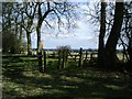
Treeline, bridleway from A5
View from gated bridleway across fields towards M6/M1 Catthorpe interchange.
Image: © Michael Westley
Taken: 16 Mar 2010
0.12 miles
9
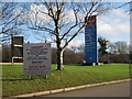
Europark, A5 near Clifton Upon Dunsmore
Industrial Park - signs at entrance - reminding drivers (twice) to only turn left in & out - the location is a black-spot for collisions on A5. Planning permission for improvements have been prepared as long as 2 years ago - still waiting for changes. Europark has a number of major companies on site, including Morgan Est and Balfour Beatty Utility Solutions.
Image: © Michael Westley
Taken: 26 Nov 2009
0.16 miles
10
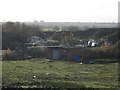
Builders Yard, A5 near Newton (view south)
View from site of old petrol station on A5 Watling Street, near entrance to Europark. Access to site in photo is from right of way and drive to left of where this photo was taken. ROW goes through the middle of the yard, and has an ingenious solution to ROW diversion (answer Image]) - clue is in photo to right of yellow JCBs in centre of photo.
For interest, the photo is looking in direction of Rugby town centre - on skyline to left can be seen the 2 blocks of flats at Biart Place Image
On skyline, right of centre can be seen the steeple of St Andrews Church Image] on Church Street.
Image: © Michael Westley
Taken: 26 Nov 2009
0.18 miles