IMAGES TAKEN NEAR TO
Sanford Close, COVENTRY, CV2 2QU
Introduction
This page details the photographs taken nearby to Sanford Close, CV2 2QU by members of the Geograph project.
The Geograph project started in 2005 with the aim of publishing, organising and preserving representative images for every square kilometre of Great Britain, Ireland and the Isle of Man.

There are currently over 7.5m images from over14,400 individuals and you can help contribute to the project by visiting https://www.geograph.org.uk
Image Map
Images are licensed for reuse under creativecommons.org/licenses/by-sa/2.0
Notes
- Clicking on the map will re-center to the selected point.
- The higher the marker number, the further away the image location is from the centre of the postcode.
Image Listing (42 Images Found)
Images are licensed for reuse under creativecommons.org/licenses/by-sa/2.0
Image
Details
Distance
1
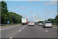
M6 near Foleshill, Coventry
Heading north west at Marker 152.5
Image: © J. Hannan-Briggs
Taken: 18 Jul 2015
0.07 miles
2
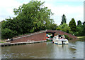
Oxford Canal south-east of Bedworth, Warwickshire
When the M6 was built the Wyken Colliery Arm was partly filled in, and rerouted through the "New Wyken Colliery Arm" the entrance being through this bridge. Now with the colliery closed, the arm is used by the Coventry Cruising Club.
The arm is also used by the Coventry Canal Society who originally cleared the arm to make it usable for boating in 1959.
Image: © Roger D Kidd
Taken: 10 Jun 2008
0.10 miles
3
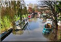
Canal arm to the Wyken Basin
This arm of the Oxford Canal originally led to the Wyken Colliery. It was restored in the 1950s by the Coventry Canal Society.
Image: © Mat Fascione
Taken: 7 Nov 2020
0.11 miles
4
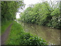
Oxford Canal Walk
Oxford Canal Walk heading to Wyken Arm Junction
Image: © Shaun Ferguson
Taken: 30 May 2016
0.11 miles
5
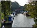
Old Main Pit Canal Arm
Along the Oxford Canal near Whiting's Bridge. The canal arm leads to the Coventry Cruising Club.
Image: © Mat Fascione
Taken: 11 Sep 2014
0.12 miles
6
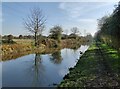
Towpath along the Oxford Canal
This stretch of the canal is between bridges 5 and 7.
Image: © Mat Fascione
Taken: 7 Nov 2020
0.12 miles
7
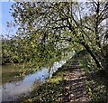
Towpath along the Oxford Canal
This stretch of the canal is between bridges 5 and 7.
Image: © Mat Fascione
Taken: 7 Nov 2020
0.12 miles
8
The Oxford Canal north-east of Coventry
When the M6 was built the Wyken Colliery Arm was partly filled in, and rerouted through the "New Wyken Colliery Arm" the entrance of which can be seen ahead here. Now with the colliery closed, the arm is used by the Coventry Cruising Club.
The arm is also used by the Coventry Canal Society who originally cleared the arm to make it usable for boating in 1959.
Image: © Roger D Kidd
Taken: 10 Jun 2008
0.12 miles
9
Oxford Canal south-east of Bedworth, Warwickshire
When the M6 was built the Wyken Colliery Arm was partly filled in, and rerouted through the "New Wyken Colliery Arm" the entrance of which can be observed branching left here. Now with the colliery closed, the arm is used by the Coventry Cruising Club. The arm is also used by the Coventry Canal Society who originally cleared the arm to make it usable for boating in 1959.
Whiting's Bridge (No 5) is ahead with Hawkesbury Junction about a mile further on.
Image: © Roger D Kidd
Taken: 10 Jun 2008
0.12 miles