
IMAGES TAKEN NEAR TO
Marshbrook Close, COVENTRY, CV2 2NW
Introduction
This page details the photographs taken nearby to Marshbrook Close, CV2 2NW by members of the Geograph project.
The Geograph project started in 2005 with the aim of publishing, organising and preserving representative images for every square kilometre of Great Britain, Ireland and the Isle of Man.

There are currently over 7.5m images from over14,400 individuals and you can help contribute to the project by visiting https://www.geograph.org.uk
Image Map
Images are licensed for reuse under creativecommons.org/licenses/by-sa/2.0
Notes
- Clicking on the map will re-center to the selected point.
- The higher the marker number, the further away the image location is from the centre of the postcode.
Image Listing (34 Images Found)
Images are licensed for reuse under creativecommons.org/licenses/by-sa/2.0
Image
Details
Distance
1
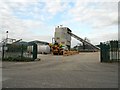
Coventry-Alderman's Green Industrial Estate
A ready mix concrete supplier on Barlow Road.
Image: © Ian Rob
Taken: 16 May 2012
0.14 miles
3
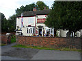
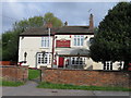
The Boat Inn, Shilton Lane
The pleasant weather has brought a few drinkers out at the front of this pub. Despite the canal-inspired name, it is now separated from the cut by the M6.
Image: © Stephen McKay
Taken: 22 Sep 2012
0.14 miles
4
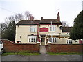
The Boat Inn Pub, Coventry
Shilton Lane, Coventry, CV2 1NL - close to Oxford Canal bridge No 7.
Image: © canalandriversidepubs co uk
Taken: 5 Feb 2010
0.15 miles
5
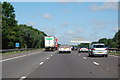
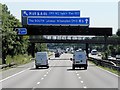
M6 near Foleshill, Coventry
Heading north west at Marker 152.5
Image: © J. Hannan-Briggs
Taken: 18 Jul 2015
0.16 miles
7
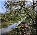
Towpath along the Oxford Canal
This stretch of the canal is between bridges 5 and 7.
Image: © Mat Fascione
Taken: 7 Nov 2020
0.18 miles
8
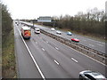
M6 Motorway near Sowe Common
An articulated Sainsbury's delivery lorry trundles northbound along the M6 on the last day of 2011.
Image: © Nigel Cox
Taken: 31 Dec 2011
0.18 miles
9
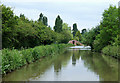
The Oxford Canal north-east of Coventry
When the M6 was built the Wyken Colliery Arm was partly filled in, and rerouted through the "New Wyken Colliery Arm" the entrance of which can be seen ahead here. Now with the colliery closed, the arm is used by the Coventry Cruising Club.
The arm is also used by the Coventry Canal Society who originally cleared the arm to make it usable for boating in 1959.
Image: © Roger D Kidd
Taken: 10 Jun 2008
0.19 miles
10
Ringwood Highway
Showing position of Postbox No. CV2 403.
See Image] for postbox.
Image: © JThomas
Taken: 4 Mar 2017
0.19 miles