
IMAGES TAKEN NEAR TO
Carroll Close, RUGBY, CV22 7XA
Introduction
This page details the photographs taken nearby to Carroll Close, CV22 7XA by members of the Geograph project.
The Geograph project started in 2005 with the aim of publishing, organising and preserving representative images for every square kilometre of Great Britain, Ireland and the Isle of Man.

There are currently over 7.5m images from over14,400 individuals and you can help contribute to the project by visiting https://www.geograph.org.uk
Image Map
Images are licensed for reuse under creativecommons.org/licenses/by-sa/2.0
Notes
- Clicking on the map will re-center to the selected point.
- The higher the marker number, the further away the image location is from the centre of the postcode.
Image Listing (28 Images Found)
Images are licensed for reuse under creativecommons.org/licenses/by-sa/2.0
Image
Details
Distance
1
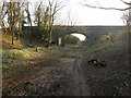
Cawston-Dismantled Railway
The former Rugby-Leamington line is being cleared and a cycle/pathway is being constructed.
Image: © Ian Rob
Taken: 1 Mar 2012
0.09 miles
2

Cawston
The old part of Cawston, seen from the footpath to Lawford Heath.
Image: © Ian Rob
Taken: 6 Jun 2006
0.11 miles
3
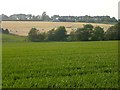
Cawston
View from the bridge over the railway facing Lawford Heath.
Image: © Ian Rob
Taken: 6 Jun 2006
0.12 miles
4
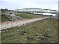
Cawston-Rugby Western Relief Road
A bridge has been constructed to carry the bridlepath from Cawston to Lawford Heath over the new road.
Image: © Ian Rob
Taken: 17 Mar 2009
0.12 miles
5
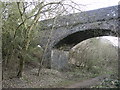
Cawston-Dismantled Railway
The three arched bridge carrying the Bridlepath over the old Rugby-Leamington Railway.
Image: © Ian Rob
Taken: 17 Mar 2009
0.12 miles
6
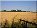
Cawston Bridleway
How the bridleway looked before the Western Relief Road and footbridge were built.
Image: © Ian Rob
Taken: 18 Jul 2006
0.12 miles
7
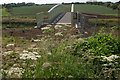
Bridleway to Lawford Heath
After crossing the overgrown old railway bridge, the bridleway now heads across this impressive new bridge over the Rugby Western Relief Road - at least it gives walkers a break from being stung by nettles and scratched by brambles.
Image: © Stephen McKay
Taken: 14 Jun 2009
0.13 miles
8

Trussell Way, Cawston
Trussell Way ends at a gate beyond which is the Linden Homes' building site. This is all part of their 'The Spinneys' development at the southern end of Cawston.
Image: © Stephen McKay
Taken: 21 Jan 2021
0.13 miles
9
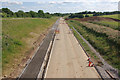
Rugby Western Relief Road
Looking towards Potford's Dam; this stretch of the new road is nearing completion.
Image: © Stephen McKay
Taken: 14 Jun 2009
0.14 miles
10
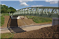
Rugby Western Relief Road
This southern section of the new road, between Potford's Dam and New Bilton is nearing completion. A substantial new bridge has been constructed here to carry a bridleway between Cawston and Lawford Heath; whether the expense is really justified to carry the minuscule amount of bridleway traffic is debatable.
Image: © Stephen McKay
Taken: 14 Jun 2009
0.14 miles