
IMAGES TAKEN NEAR TO
Red Lodge Drive, RUGBY, CV22 7TT
Introduction
This page details the photographs taken nearby to Red Lodge Drive, CV22 7TT by members of the Geograph project.
The Geograph project started in 2005 with the aim of publishing, organising and preserving representative images for every square kilometre of Great Britain, Ireland and the Isle of Man.

There are currently over 7.5m images from over14,400 individuals and you can help contribute to the project by visiting https://www.geograph.org.uk
Image Map
Images are licensed for reuse under creativecommons.org/licenses/by-sa/2.0
Notes
- Clicking on the map will re-center to the selected point.
- The higher the marker number, the further away the image location is from the centre of the postcode.
Image Listing (43 Images Found)
Images are licensed for reuse under creativecommons.org/licenses/by-sa/2.0
Image
Details
Distance
1
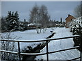
Bilton-Deepmore Road
Snow on the banks of the Sow Brook
Image: © Ian Rob
Taken: 6 Jan 2010
0.02 miles
2
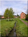
Old Bilton-Deepmore Road
The Sow Brook is the boundary between Old Bilton and Rugby.
Image: © Ian Rob
Taken: 1 May 2008
0.02 miles
3
Bilton-Barton Road
At the junction with David Road.
Image: © Ian Rob
Taken: 18 Dec 2011
0.07 miles
4
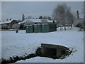
Bilton-Deepmore Road
Two tunnels take the Sow Brook under Deepmore Road.
Image: © Ian Rob
Taken: 6 Jan 2010
0.07 miles
5
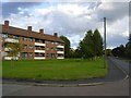
Rugby-Deepmore Road
Council owned flats next to the Sow Brook.
Image: © Ian Rob
Taken: 28 Aug 2011
0.08 miles
6

Rugby-Shakespeare Gardens
New Flats built on the site of a Petrol Station.
Image: © Ian Rob
Taken: 31 Jan 2009
0.08 miles
7
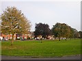
Rugby - Shakespeare Gardens
Line of trees for over half a mile in this residential area built in late 1950s. The Sow Brook runs along a Culvert beneath this Green and returns to the surface about 50m north west of this point.
Image: © Ian Rob
Taken: 15 Oct 2006
0.08 miles
8
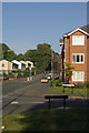
Overslade
Looking along Overslade Lane at its junction with Shakespeare Gardens. The modern block of flats on the right was built on the site of a former garage.
Image: © Stephen McKay
Taken: 12 Oct 2008
0.08 miles
9
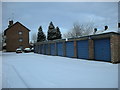
Bilton-Deepmore Road
Council owned flats and garages.
Image: © Ian Rob
Taken: 6 Jan 2010
0.09 miles
10
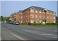
Rugby-Overslade Lane
Flats built on the site of a former Filling Station and Co-op Store.
Image: © Ian Rob
Taken: 20 Apr 2011
0.09 miles